Updated 30 Aug 2014
|
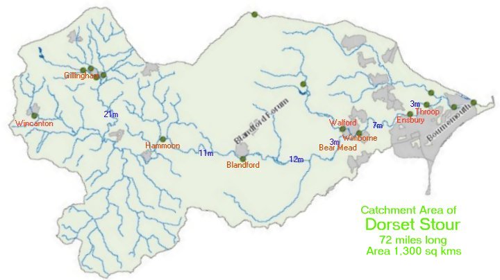
Dorset Stour - Recording stations Data
|
|
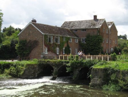
Dorset Stour - Durweston Mill hatches.
|
Measuring the delay between rain falling and level
crest arriving at different places along a river.
Approx. calibration between these places and Bear Mead.
Transit speeds calculated from distance along the river.
Dorset Stour used over 47 miles. Data from
Environment Agency Level recording stations,
BBC weather radar records,
and Google Earth tools.
|
Recording Stations along Dorset Stour:
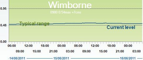
Gillingham,Hammoon, Blandford, Wimborne.
Gillingham-Hammoon=21.13 miles
Hammoon-Blandford=10.76 miles
Blandford-Bear Mead=11.92 miles
Bear Mead-Wimborne=3.23 miles
Total=47.04 miles along river.
|
Catchment area of the Dorset Stour,
with Recording Stations
and distance between stations along river in miles.
|
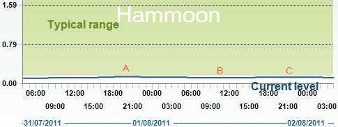
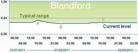
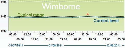
Peak caused by heavy rain (c34mms), and its decreasing delay as it propagates
down a widening river, which had low water level due to near-drought conditions.
|
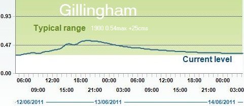 |
31hrs delay
21miles
0.7mph
|
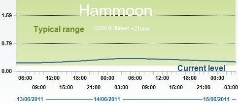 |
12hrs delay
11miles
0.9mph
|
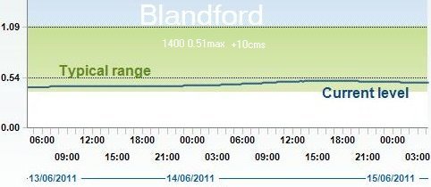 |
19hrs delay
15miles
0.8mph
|
 |
|
Durweston Mill |
effect of hatches opening |
7.6 miles
Durweston Mill
|
3.2 miles
15 miles 22 hrs
|
Levels taken from public websites for:
Gillingham |
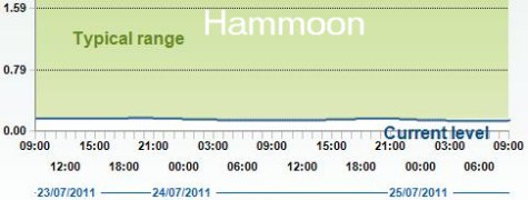
Hammoon |
Blandford |
Wimborne and the author's own
measurements for Bear Mead.
Distance along river in miles using Google Earth:
Source(0)-Gillingham(7.22)-Hammoon(28.32)-Blandford(39.12)-Bearmead(51.02)-Wimborne(54.25)-Sea(71.95)
Delay varies greatly with height of water in river.
Delay (approx) in hours (for low crest):
Rain(0)-Gillingham(4)-Hammoon(22.5)-Blandford(27.5)-Bearmead(33)-Wimborne(34.5)-Sea
|
Gillingham Hammoon    Blandford  Bear Mead Wimborne
72m        40.900m    31.0m      c19 m     14.603m AOD
ID=3296    ID=3306    ID=3305      none    ID=3302
ST805266   ST820147   ST88330595 SY986993  SZ024992
All times in GMT
|
|
|
Effect of opening Durweston hatches
|
Hatches at Durweston Mill.
Each arch contains 3 hatches: total 9 hatches

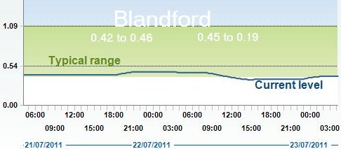
River rises 11 cms in 4 hrs at 2200 hrs on 17 Jul 2011,
as 3 of 9 Durweston Mill hatches are opened
then closed because of weed blockage.
Peak of 0.51 is followed by a trough of 0.25, 9 hours later. Peak
reached Wimborne (15 miles) after 22 hours delay (0.69 mph),
propagation time is very slow because the river is unusually low.

|
Progress of Durweston Slosh downstream
|
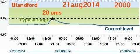
1.
Slosh first recorded at Blandford.
Hatches opened 1800 hrs then closed 0800 hrs next day,
river drops then recovers.
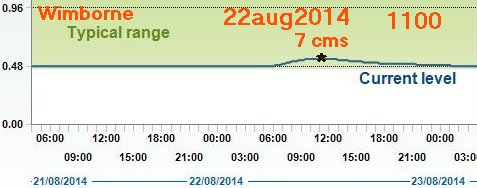
2.
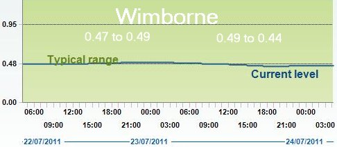
Slosh next recorded at Bear Mead as 144 at 1600 (on max)
and 135 at 1300 (on min).
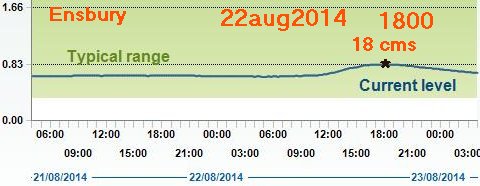
3.
Slosh last recorded at Wimborne.
Average delay 22 hours over 15 miles
from Blandford to Wimborne (0.68 mph).
|
This disturbance was confirmed by phoning Durweston Mill
on 22 Aug 2014. The cause was raising the hatches of the Mill
about 2100 hrs on 21aug2014, preparatory to clearing out
jammed flotsam next morning.
|
DURWESTON Mill |
(3.2 miles 3 hours = 1.1 mph) |
 |
(12 miles 12 hours = 1.0 mph) |
BEAR MEAD
0800 |
(3 miles 3 hours = 1.0 mph) |
 |
(7 miles 7 hours = 1.0 mph) |
 |
(3 miles 2 hours = 1.5 mph) |
 |
(TOTAL: 28.2 miles 27 hours = 1.04 mph) |
Compiled, formatted, hyperlinked, encoded,
and copyright © 2011, John Palmer,
 All Rights Reserved. All Rights Reserved.
|