Possible water extractions
[after x days of drought]
31mar2004[9]...
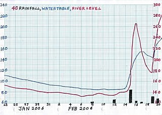
06feb2006[17]...
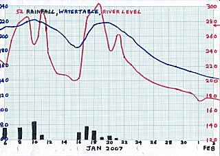
01feb2007[11]...
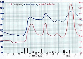
15mar2010[15]...
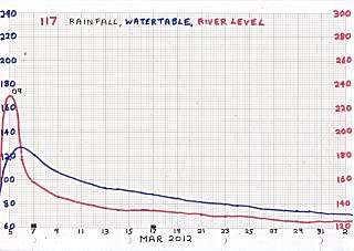
29feb2012[24]...
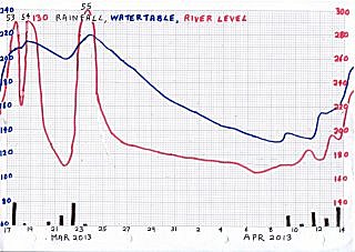
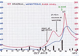
06apr2013[14]...
21apr2013[8]...
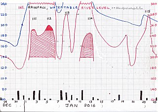
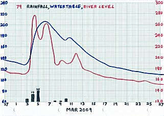
Feb, Mar, Apr....
9-24 day drought...
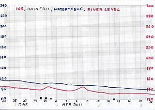
Level 130-180...
Groundwater 85-145
|
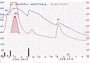
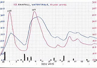
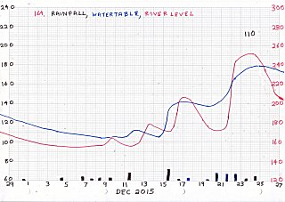
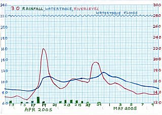
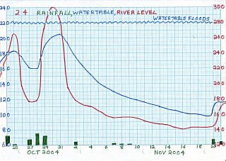
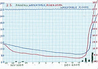
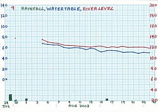
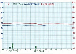
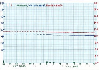
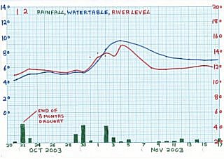
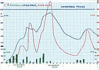
Floods since July 2003:
2003 none |
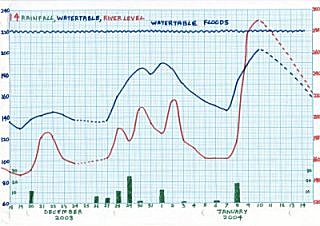
2004 none |
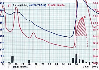
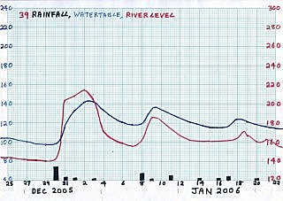
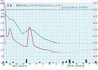
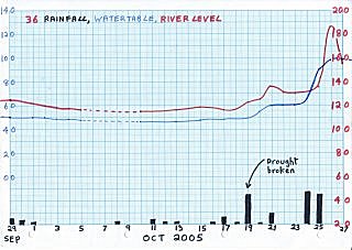
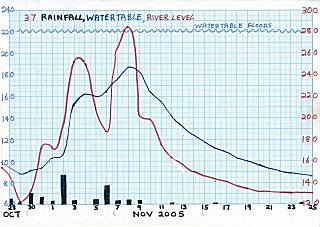
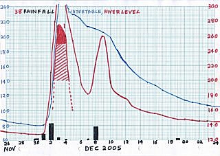
2005 Dec 3 |
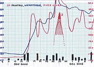
2006 Nov 26, Dec 31 |
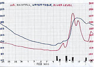
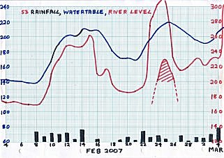
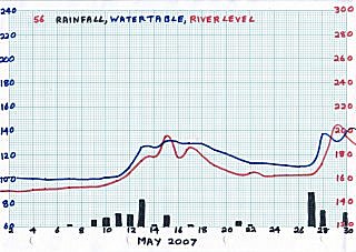
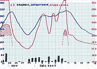
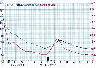
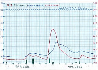
2007 Mar 6 |
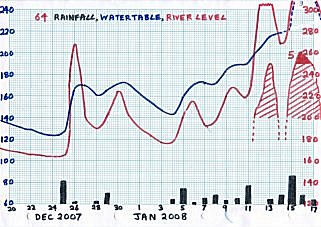
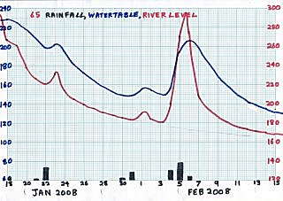
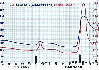
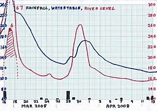
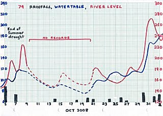
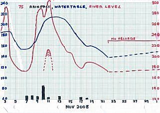
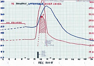
2008 Jan 16, Mar 17, Dec 15 |
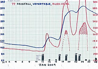
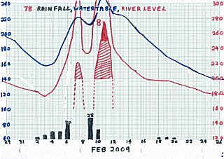
2009 Feb 10,
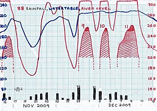
Nov 30, Dec 4, Dec 9 |
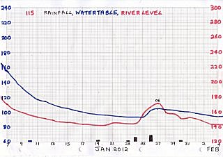
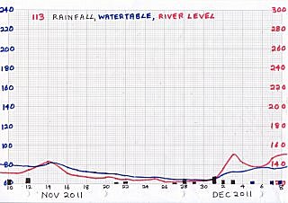
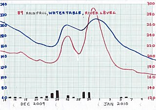
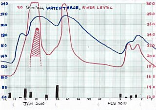
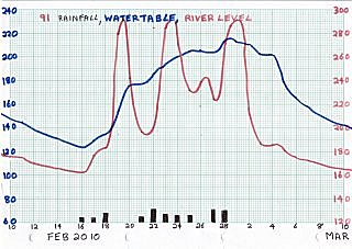
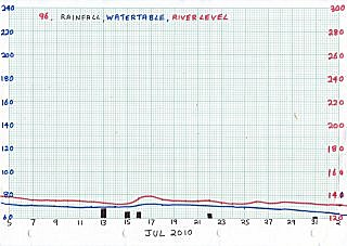
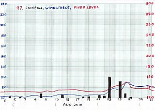
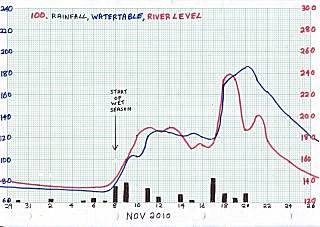
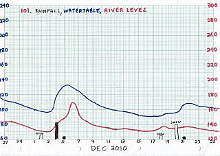
2010 none |
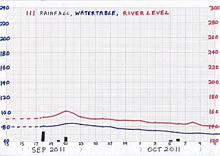
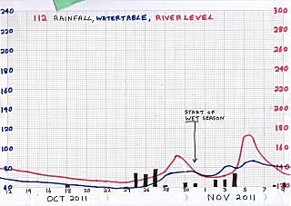
2011 none |
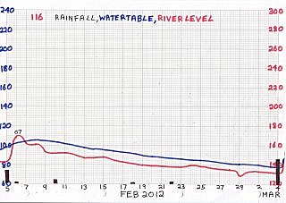
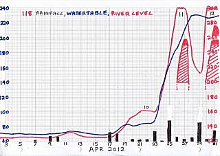
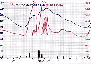
2012 Apr 27,
May 01, May 02, Jul 08,
Nov 21,23,25,26 |
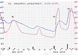
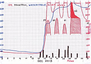
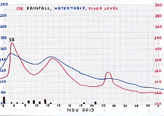
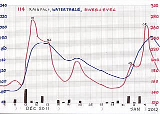
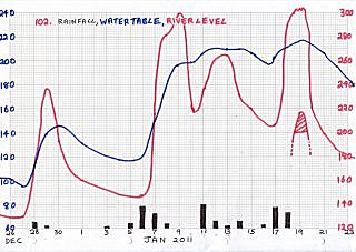
2013 Jan 14,29 | Dec 24 |
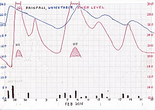
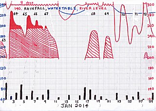
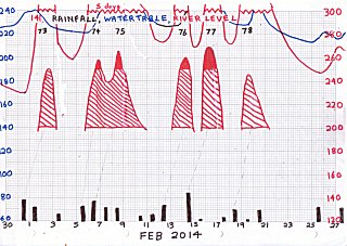
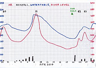
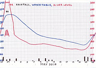
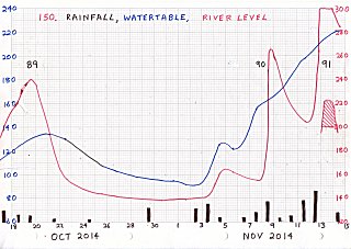
2014 Jan 2,6,7,9 | Feb 7,8,14,16 |
|
| |
|
|
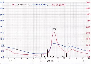
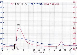
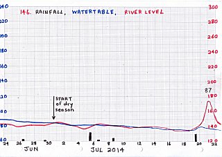
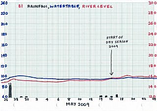
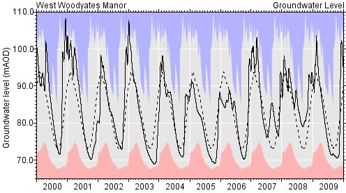
DRY SEASON Groundwater
Year START | END | MIN | MAX |
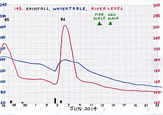
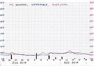
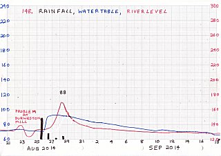
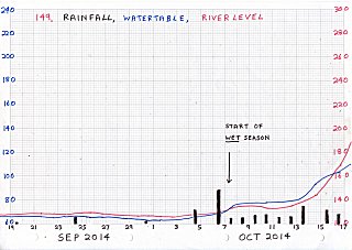
2014 Jun30 | Oct07 | 64 | 240+ |
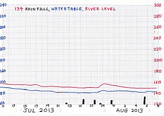
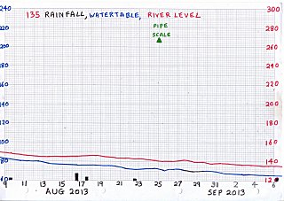
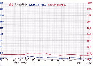
2013 Jun09 | Oct23 | 60 | 240+ |
2012 - | - | 90 | 240+ |
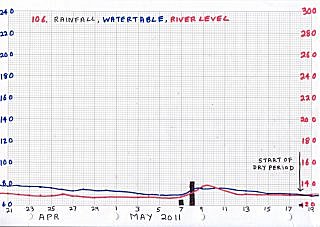
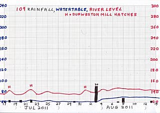
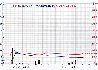
2011 May18 | Oct31 | 60 | 215 |
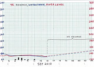
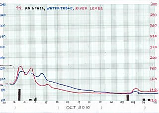
2010 Jun18 | Nov08 | 65 | 215 |
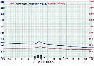
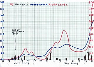
2009 May16 | Oct21 | 60 | 240+ |
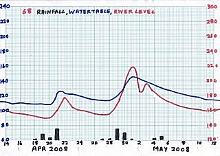
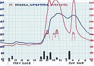
2008 - | Oct07 | 85 | 240+ |
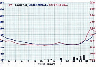
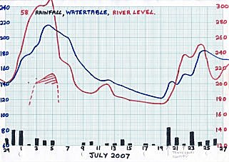
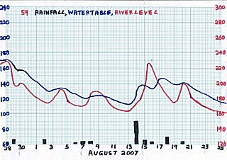
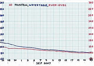
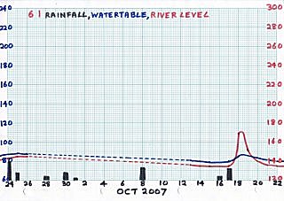
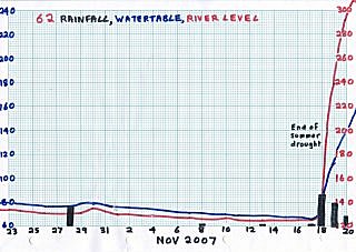
2007 - | Nov18 | 70 | 240+ |
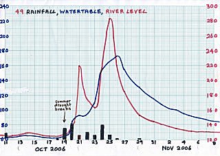
2006 - | Oct19 | 60 | 240+ |
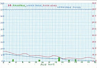
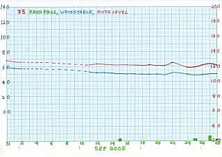
2005 Jun02 | Oct19 | 50 | 240+ |
2004 Jun17 | Oct01 | 70 | 210 |
2003 - | Oct22 | 40 | 210 |
|
|


 All Rights Reserved.