Updated 21 Dec 2011
|
Jurassic sea-level challenge
|
|
Jurassic sea-level challenge.
|
by 
|
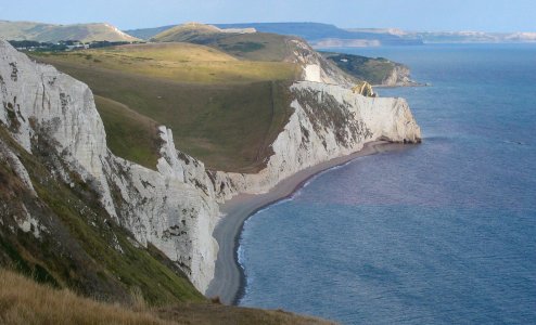
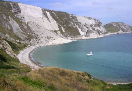
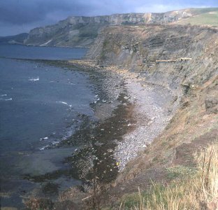
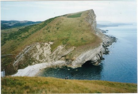
THE CHALLENGE is to walk and swim AT SEA LEVEL from
Kimmeridge to Osmington Mills along the Jurassic Coast of Dorset.
See emails
|
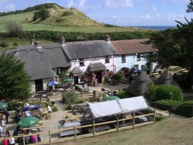
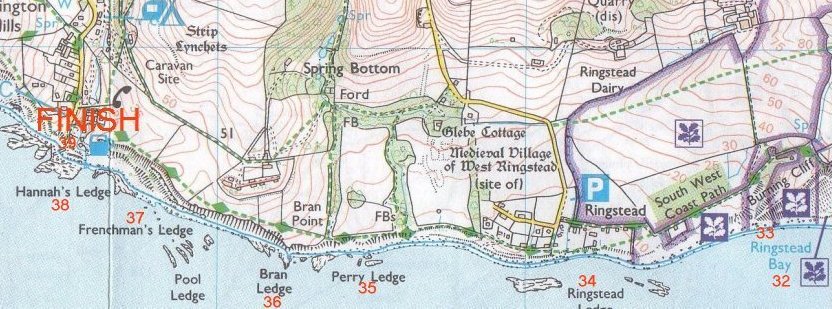
FINISH: Smuggler's Inn, Osmington Mills.
 |
3 miles of swimming
9 miles of walking
about 7 hours
|
START: Kimmeridge Car Park on cliff top.
 |
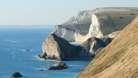
The distance is about 12 miles, the landscape is superb.
Friends and relations can follow along the cliff-top and shout encouragement.
There are Car Parks at each end and 3 more in between.
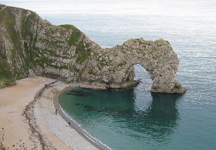
Attempts must be made in August, when the Army is not shooting and the
Range walks are open.
Warm, still weather is needed.
An early start should be made, it may take 8 to 10 hours.
Transport is needed to the Start and from the Finish.
Suggested equipment is a pair of strong deck shoes, trunks, a bright T-shirt
and a small nylon rucksac to carry drinking water. Flippers, goggles and
snorkel are very useful. Also a small digital camera and mobile phone in a
diver's bag to stay in touch with your cliff-top team.
Water is important, there are very few water-points on route, water
should be carried or supplied by companions.
Planning is important, on the longer swims, don't try to swim against
a tidal current. Consulting tide tables is essential.
If this is your first attempt, why not try just part of the route, to
get the feel of the rocks, pebbles, sand and water, and the reliability of
your companions?
The author thinks the hardest part of the route is
Pondfield.
The webmaster and his wife tried this challenge about 5 times before
succeeding.
Contact for advice and help.
Names, dates and accounts of successful attempts will be kept on
this webpage.
Short emails about the challenge will also be kept on this page.
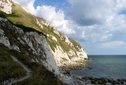
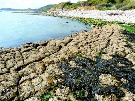
A collection of 120 photos from Geograph.org.uk
shows the kind of walking or swimming to be done.
See also curious events that have happened to the author.
|
Maps in panorama |
Swims in BLUE |
SCROLL right |
===============> |
8.
 |
7.
 |
6.
 |
5.
 |
4.
 |
3.
 |
2.
 |
1.
 |
Best bits |
all in 9 miles! |
SCROLL right |
===============> |
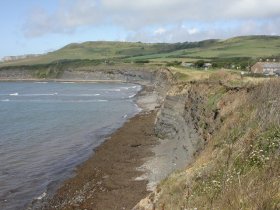
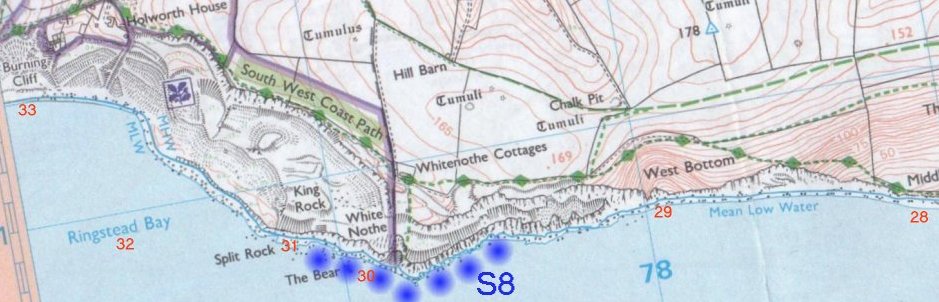
30. White Nothe.
 |
29. Fountains Rock, West Bottom.
 |
28. Middle Bottom.
 |
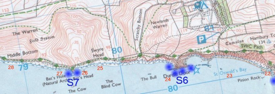
27. Bat's Hole.
 |
26. Bat's Head.
 |
25. Swyre Head.
 |
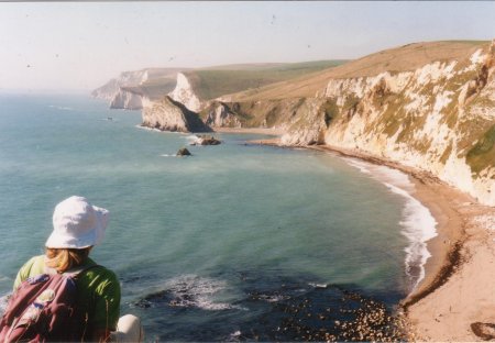
24. Durdle Door.
 |
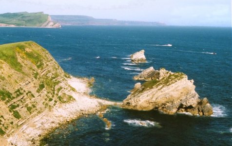
23x. Man o' War Bay.
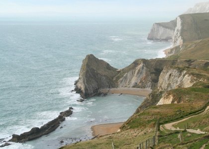 |
23a. St Oswald's Bay.
 |
23b. St Oswald's Bay
 |
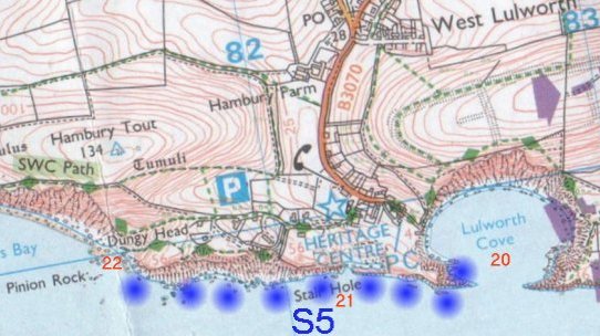
22. Dungy Head
 |
21. Stair Hole
 |
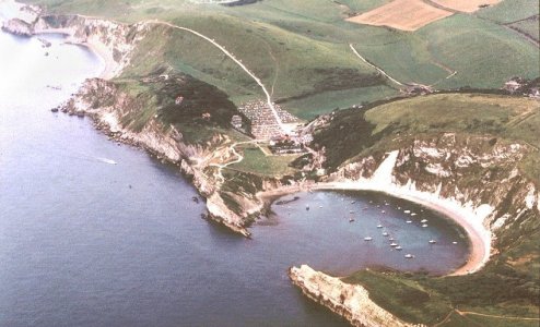
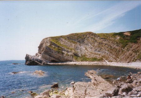
20. Lulworth Cove.
 |
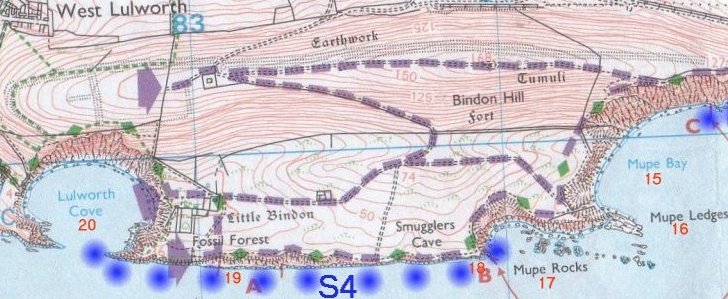
18. Smugglers Cave
 |
17. Mupe Rocks
 |
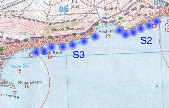
15. Mupe Bay
 |
14. Black Rock
 |
13. Arish Mell
 |
12. Cow Corner
 |
11. Worbarrow Bay
 |
10. Worbarrow Tout
 |
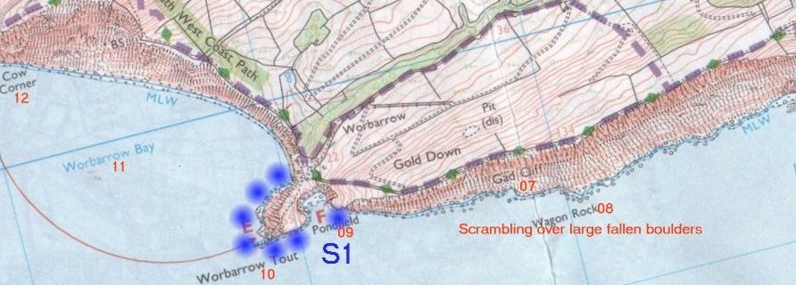
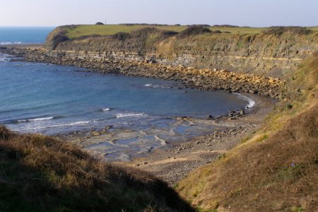
09. Pondfield
 |
07. Gad Cliff
 |
06a. Brandy Bay
 |
06b. Brandy Bay
 |
05. Long Ebb
 |
04. Hobarrow Bay
 |
03. Broad Bench
 |
02. Charnel
 |
01. Kimmeridge Car Park
 |
The Route |
Click on names to see photos |
From the Author's collection |
of 500 photos taken along this coast |
SCROLL right |
===============> |
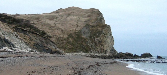
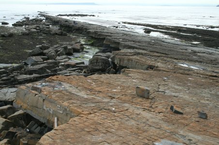
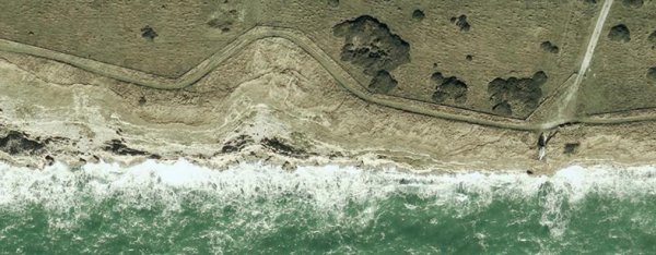
37. Frenchman's Ledge
Almost the end of the walk, these ledges and boulders feel worse than
they are on weary legs. Resist the easy option to walk along the path
on the low cliff. The Challenge is to walk at Sea Level!
 |
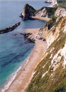
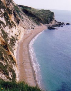
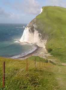
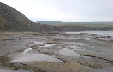
23. St Oswald's Bay
A lovely sweeping sandy bay, with interesting caves
in the cliff. Gets a bit "tight" at the little headland,
before passing on to Man o' War bay, a real sun-trap,
very popular, protected from the surf by the Man o' War rocks,
which can be climbed onto. Go inside of Man o' War Rocks, the
water is sometimes so warm you think someone's pee'd in it!
 |
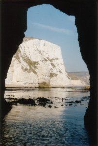
18. Smuggler's cave
Also called Bacon Hole, a spectacular area worth a day's exploring,
but the start of a serious swim to the East jaw of Lulworth Cove.
Most important to make sure that the tidal current is Westgoing
during your swim. Goggles and snorkel allow the swimmer
to see the interesting rocky bottom.
 |
14. Black Rock
An easy swim, but the water has some big seaweed and can be milky from
fallen cliff round here. Stick to shallow water to avoid losing direction,
and suddenly you find yourself at a nice shingle beach and a wide cave.
 |
12. Cow Corner
The start of an easy swim to the delightful Arish Mell shingle cove,
passing an extensive sea cave system, worth exploring but maybe on
another day.
 |
08. Wagon Rock
A huge fallen rock, about half way along a 2 km scramble over masses
of fallen boulders. Above you towers the spectacular Gad cliff, with
Coast path and great views at the top. The scramble is hard going and
needs agility to keep up time. At the end is the first swim
across Pondfield, although short don't try it in rough water.
On a warm day, dehydration can be a problem here.
 |
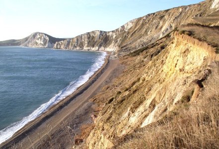
06. Brandy Bay
A magic place. The end of the easy walking over ledges
and the start of the hard work clambering over huge boulders.
The beach here is often covered with driftwood ideal for a fire,
with only the rare person to object.
 |
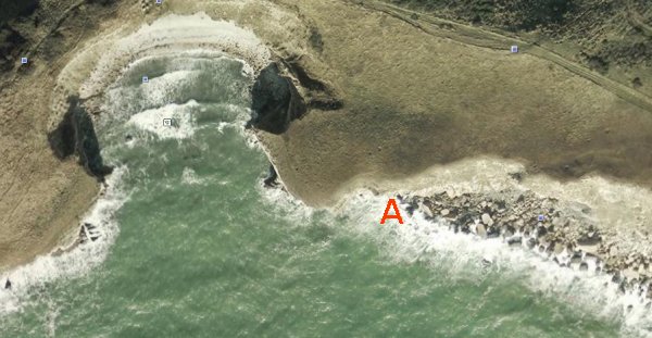 |
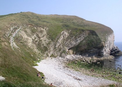
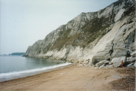
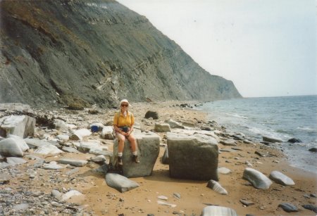
Pondfield
In the author's opinion, the most difficult part of the whole route,
which seems to hinge at this innoucuous little cove.
After nearly 2 km of clambering over big rocks from Brandy Bay,
you are faced (at point A) with your first swim,
across the mouth of the
little bay called Pondfield and round Worbarrow Tout.
Once launched, you can't get back.
There is no alternative, either swim or quit the challenge, but
Don't let loss of face force you into a rash decision.
Round Worbarrow Tout is easy and attractive, but in anything
but smooth sea, Pondfield tends to funnel the waves and it can
be dicey crossing the "neck". Heading for Pondfield beach instead
is not much better, rollers can be nasty at the beach where there
are large stones. Better to head for deep water, before the rollers
develop. This is where flippers are most useful, unless you are a
very strong swimmer. Check your Tide Tables for current! If you decide
to return, it is possible to climb to the cliff top at Brandy Bay
if you know where you're going (bear right halfway up, keep to the soft
ground). But it is more sensible to go right back to Kimmeridge Car
Park.
|
 |
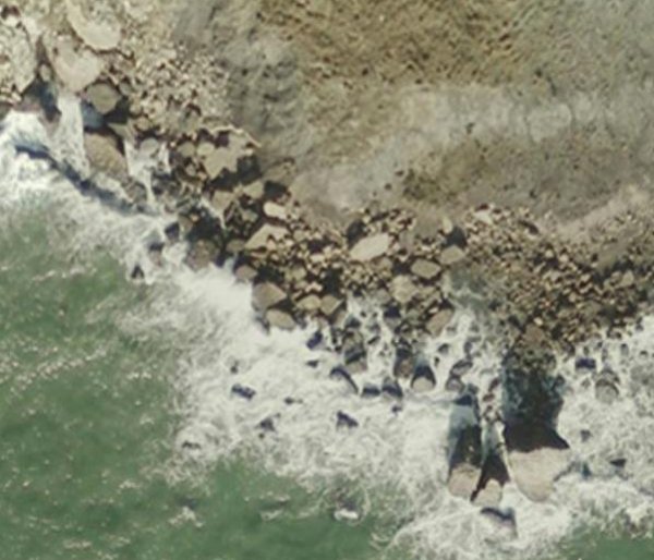 |
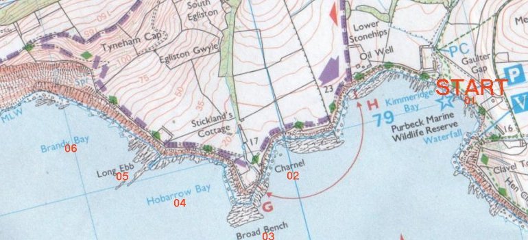
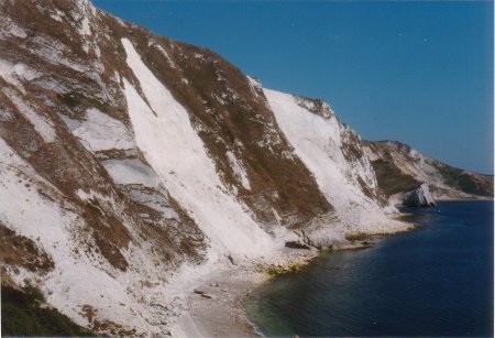
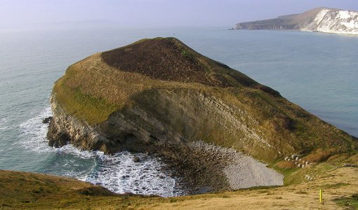
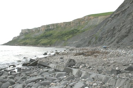
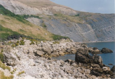
Gad Cliff
A difficult part of the route is the 2 km section at the
bottom of Gad Cliff. Allow 60 minutes.
Very large boulders have fallen from the cliff above, and litter
the shoreline. These have to be clambered over or squeezed between,
a tiring process. In the bottom right of this Google earth photo
is Wagon Rock, the largest of them all. It is easy to get dehydrated
here because of the height of the cliff, which catches the sun and halts
any breeze. It is impossible to climb the cliff, boats cannot get close
to the shore and helicopters would have a problem rescuing you. Have
a buddy and don't break a leg! Look out for the wild sheep. About half way
there is a tiny harbour, large enough for a couple of row boats.
|
 |
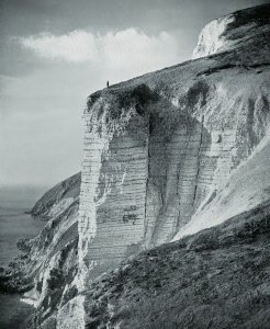
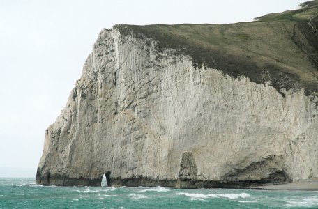
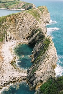
Fossil Forest
Another difficult part is the 1,300 metre swim from the Smugglers Cave
to Lulworth Cove, under the cliff that holds the Fossil Forest. The problems
are: speed of current and coldness of water. The sea is deep right up to
the cliff and current runs fast, make sure its with you not against! The water
is colder here than anywhere else on the route, make sure you're not too thin!
Swim right up against the cliff, goggles are really useful here to weave
between submerged rocks. The fossil trees half way up the cliff are
invisible from sea level.
|
Photographs have been chosen to illustrate
the type of walking or swimming along
the Challenge route from Kimmeridge to Osmington Mills.
Links are provided to
Geograph,
where the pictures are held,
and they are in approximate order.
They are grouped by O.S. kilometre square.
|
---START---            kms
01 KIMMERIDGE Car Park 0
02 Charnel**           0.7 rocky beach
03 Broad Bench**       1.0 rocky beach
04 Hobarrow Bay**      1.4 rocky beach
05 Long Ebb**          1.7 rocky beach
06 Brandy Bay**        2.0 rocky beach
07 Gad cliff**         3.0 rock hop
08 Wagon Rock**        3.0 rock hop
09 Pondfield**         3.9 swim
10 Worbarrow Tout**    4.1 swim
11 Worbarrow Bay**     4.5 sand beach
12 Cow Corner**        4.9 swim
13 Arish Mell**        5.6 beach
14 Black Rock**        6.3 swim
15 Mupe Bay**          6.6 shingle beach
16 Mupe Ledges**       6.7 rock beach
17 Mupe Rocks**        6.8 rock beach
18 Smuggler's cave**   7.2 swim
19 Fossil Forest**     7.9 swim
20 Lulworth Cove       8.5 shingle beach
21 Stair Hole          8.8 swim
22 Dungy Head          9.5 swim
23 St Ostwald's Bay    9.7 sand beach
24 Durdle Door        10.5 swim
25 Swyre Head beach   11.0 sandy beach
26 Bat's Head         11.5 swim
27 Bat's Hole         11.5 swim
28 Middle Bottom      12.0 sandy beach
29 West Bottom        12.9 sandy beach
30 White Nothe        13.8 swim
31 King Rock          14.2 swim
32 Ringstead Bay      14.9 shingle beach
33 Burning Cliff      15.3 rocky beach
34 Ringstead Ledge    15.8 shingle beach
35 Perry Ledge        16.6 shingle beach
36 Bran Ledge         16.8 shingle beach
37 Frenchman's Ledge  17.2 shingle beach
38 Hannah's Ledge     17.5 shingle beach
39 SMUGGLERS INN      18.0 path
----FINISH----
|
|
|
|
Event at Arish Mell
On one of my attempts at the challenge,
I was resting on Arish Mell beach, getting ready to
swim to Lulworth Cove.
I wore my rucksac and T-shirt like a hiker.
Looking over my left shoulder, I saw an army
Landrover at the gate, and two soldiers
get out. They didn't see me straightaway,
then shouted "Oy". No response from me,
so they climbed the gate and came crunching
150 yards over the shingle towards me to have it out.
I let them get within 5 yards, then did
the unexpected. Straight into the sea and swam
off! I must apologise to those two soldiers,
but it has kept me laughing for 20 years.
|
|
|
Event at Brandy Bay
On another of my attempts at the challenge,
with my wife Rosie, we were walking towards Brandy Bay
to prepare for the rock-hop under Gad Cliff.
In the distance we saw a man and woman, a senior
couple, unusual in such an out-of-the-way place.
As we approached, we were horrified to see they
were not wearing a stitch of clothing. We had to pass them,
and had quite a pleasant conversation, and I managed to keep my
eyes horizontal. Two weeks later, we met them again in
our local supermarket, and had a laugh about it. I didn't
recognize them this time!
|
|
|
Event at Bat's Head
Once I told a fellow at work about the 'inaccessible'
beach below Middle Bottom, and how you could spend a day
there by swimming through Bat's Hole with all your things in
a plastic rubble bag. A couple of weeks later, after
visiting the beach, I was swimming back through
Bat's Hole when I heard a bit of splashing and a plastic
sound headed my way. It was the chap from work, with a
big black beard and a big black bag with all his things in.
We had a laugh and went our ways.
|
|
|
Event at Pondfield
I rock-hopped 2 km at the bottom of Gad Cliff with two companions.
Meantime, my wife and a friend climbed up from Brandy Bay and
walked along the cliff top to Worbarrow Tout to watch the 3 of us
swim across Pondfield.
When we reached Pondfield,
the water was very rough, and my companion's faces fell.
But they did the sensible thing and walked back to to Brandy Bay.
My friend was holding his arms in a cross, meaning "don't swim",
but I did not understand and swam.
It was rather frightening, you can't go back, or even right, but must
get out of Pondfield neck as quickly as possible and into the quieter waters
around Worbarrow Tout.
I managed this but haven't forgotten the event after 20 years.
|
|
|
Event at Fossil Forest
I swam with my brother from Lulworth Cove to Mupe Ledges,
in trunks and T-shirt as usual. My brother is very thin, but a
UK champion (indoor) swimmer. My body shape is the opposite. At the
end of the half-hour swim, he was trembling uncontrollably
with cold, while I was just 'cool'. August is nearly the
warmest month for sea temperature, so make sure you are not
too thin.
|
|
|
|
----Anyone with more details for publication on this webpage,
please email ----
*********************
John Palmer replied on 21 Dec 2011:
Hello Lynne,
Delighted to hear from you.
I know the area quite well, so just ask and I will try to help.
The Lulworth Ranges extend 7 miles out to sea, so you need to know
when they are not firing!
Suggest you go to
www.dorsetforyou.com/389942
(Lulworth Range Walks and Tyneham Village opening times 2011 and 2012),
phone the number given there, explain what you want to do.
They should be helpful.
Swims over 1km really need the current with you, which means a lot of
planning using the Tide Tables for the area. It is possible to avoid head
currents by swimming very close to the rocks. Try to avoid springs. Goggles
help you keep straight and flippers add power. Also you will need nearly
still water which means good weather. Some of the walking/scrambling
needs good legs. You will need a van and driver, to drop you at Kimmeridge
and collect you at the Smugglers Inn. I think I tried 4 times before I was
successful.
Wish I could come with you, alas I'm now too old.
Keep me posted,
John Palmer, Dorset, England
*************************
Lynne Roper wrote on 19 Dec 2011
Hi John,
Thanks so much for the amazing website and all the details on the challenge.
I've posted this on Devon Wild Swimming and we've got a lot of interest,
so we're going to go for it next year. Some of our swimmers aren't up to
the difficult bits, and will just do a couple of little swims.
We don't have any experience of this area, and I wondered whether you
could advise on a couple of things: Re Ranges, is it possible to go in
summer outside August? Is there a site with the planned firing on it?
Also, we thought we'd identify a couple of windows when the tides are
right and then go based on good weather (one of our swimmers is a
forecaster at the Met Office, usefully!) Is there an ideal tide for this
(spring/neap/middle)?
Thanks for your help, Happy Christmas!
Lynne
|
|
Compiled, formatted, hyperlinked, encoded,
and copyright © 2009,
John Palmer,
All Rights Reserved.
|