Updated 09 Jul 2012
|
Degrees of Flooding at Eye Mead
|
|
Degrees of flooding at Eye Mead, Dorset Stour.
|
The flat Dorset Stour floodplain is only viewable at
Eye Mead, half a mile downstream from Bear Mead.
Here are photos of different degrees of flooding,
taken from the same viewpoint at Little Pamphill Green,
OS ref: ST 995-002
Note: On the floodplain 850 metres South of the bridge
lies
Lake Farm Roman fortress. How did 4,500 soldiers deal with
the flooding?
|
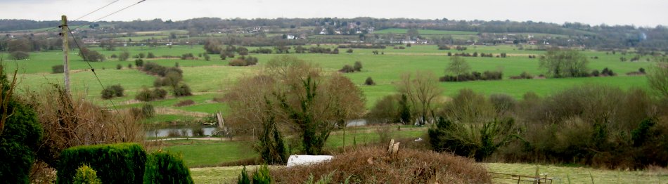
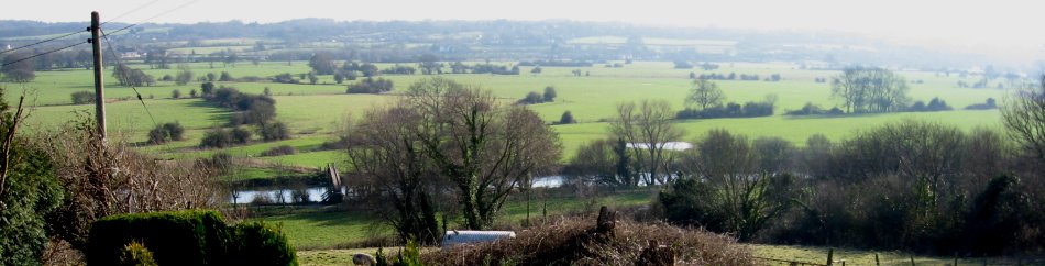
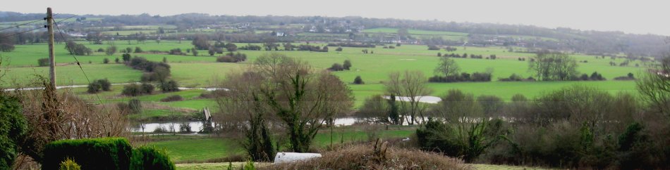
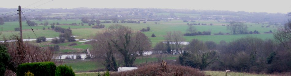
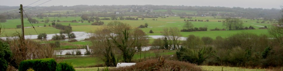
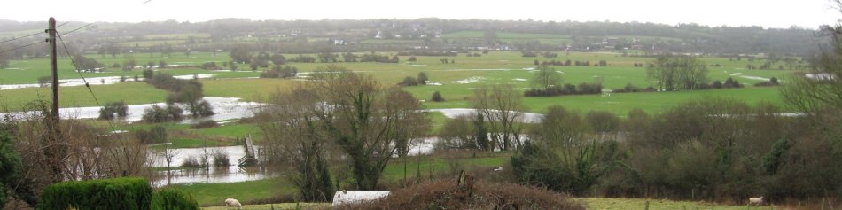
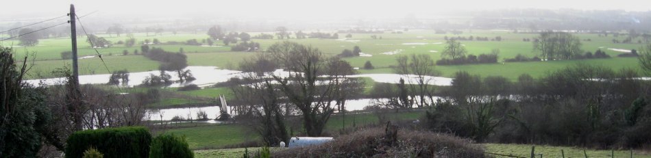
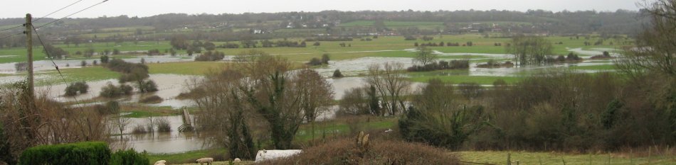
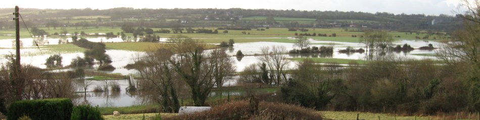
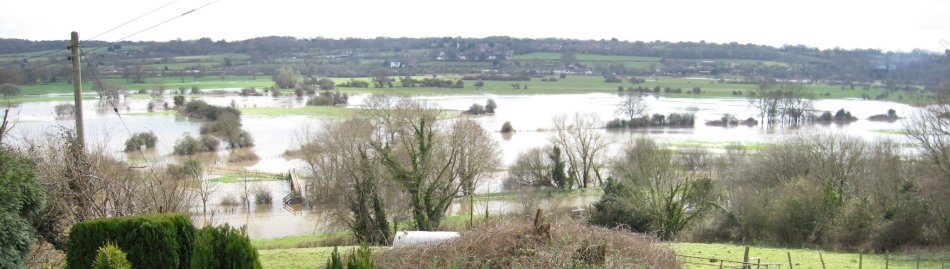
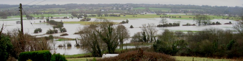
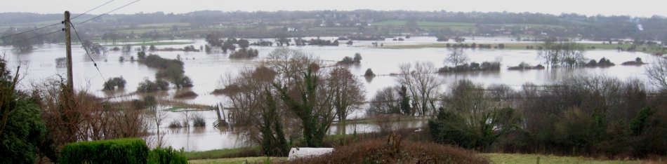
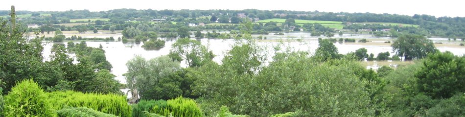
Degrees of Flooding. The Dorset Stour floodplain,
pictures centred on Eye Mead, SY 995-995.
Eye Bridge in left foreground.
|
0% flooding
|
2% flooding
|
5% flooding
|
10% flooding
|
20% flooding
|
30% flooding
|
40% flooding
|
50% flooding
|
60% flooding
|
70% flooding
|
80% flooding
|
95% flooding
|
100% flooding
|
Compiled, formatted, hyperlinked, encoded,
and copyright © 2008, John Palmer,
 All Rights Reserved. All Rights Reserved.
|