Updated 08 Jun 2011
|
Planting a new oakwood in Dorset
|
|
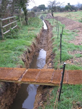
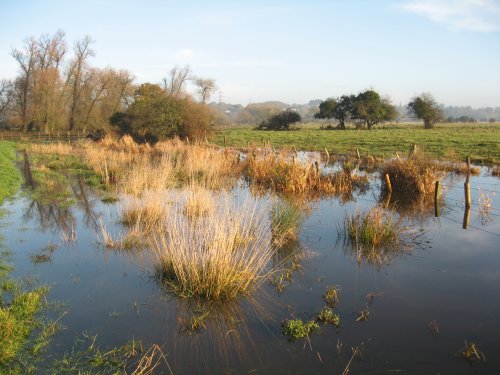
New Mill Stream, Nov 2007
|
An old silted-up arm of the River Stour is
deepened and re-connected
to the river.
Heavy rain in Nov 2007
raised the river by 7 feet, sufficient for water to cross
a hump in the connecting trench and begin flowing down 2 miles of
the old stream bed, filling the Mill Sream 'reservoir'. This has
happened 11 times since Jul 2003, a total
of 20 days. In this time, the river has flooded 4 times. A mile down
the stream bed, the water flow
leaves the old stream arm and finds an existing alternative route back
to the river near Merley Hall Farm to the South of Wimborne along "stream #5".
When the river drops below 300, the flow reverses, out of the Mill Stream,
over the hump at 300 and back into the River. The Mill Stream 'reservoir'
begins to be emptied again.
see also:
TIDAL TRENCH to control flooding.
Unblocking,
Tidying,
Theory & early results and
Results during flooding
|
62n
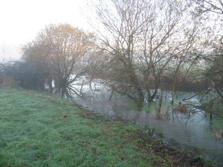
Heavy rain which ended 3 months of drought in
Nov 2007, nearly causing the River Stour to flood.
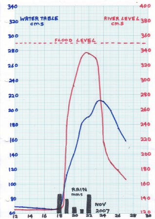 |
62o.
84 mms of rain in 5 days caused the Dorset Stour
at Bear Mead to rise 210 cms and the water table 145 cms,
from a 13-month lowpoint to 10 cms short of flooding.
As the upstream river rose to level A, water entered
the trench. At level B, water crested the 'hump' and flowed down
to start filling the Mill Stream reservoir. The reservoir
slowly rose to level C, at which point it flowed into Stream #5
and emptied into the downstream river at D.
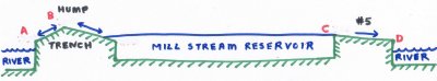
As the river fell below level B, water ceased entering the reservoir
via the trench. If the reservoir itself was above B, reverse flow took
place along the trench into the river. When the reservoir was also below
B, no flow ttok place along the trench in either direction.
As the reservoir fell further below C, flow along stream #5 was also
cut off. With no flow along trench or #5, the reservoir emptied
more slowly, as water seeped into the water table. However, this was
also high because of the near-flood, and the reservoir emptied more
slowly than usual.
The river Stour flows over clay near Bear Mead. Easy run-off causes
the river to rise quickly in response to rain, and also fall quickly
when the rain ceases. This is accentuated when the water table is also
high.
|
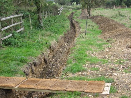
60k.
River below 130, connecting trench empty.
|
60f.
River below 130, not high enough to enter the connecting trench.
|
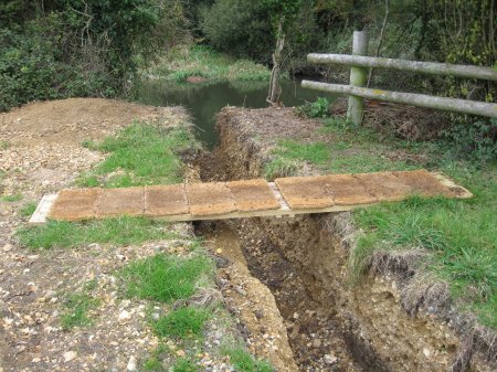
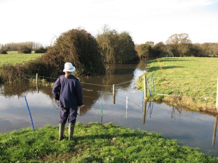
62a.
River at 292, not high enough to cross 'hump' in trench
|
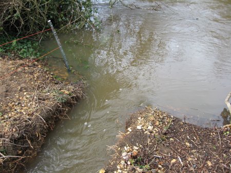
62h.
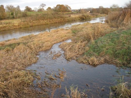
River higher than 300, water pours along trench.
|
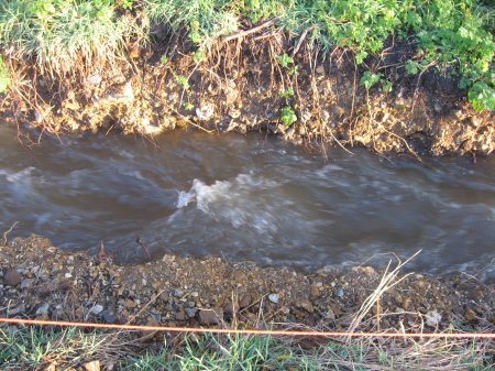
62d.
White water forms along the trench.
|
62c.
Fills area near concrete bridge.

|
62i.
Rises and fills more of area.
|
62g.
Fills area in SE of field 3.
|
62b.
Fills DL's part of Mill Stream.
|
62e.
Flows under NT bridge, 1 mile downstream.
|
62f.
Flows leaves old Stream bed, turns right into Stream 5.
|
62k.
Stream 5 after last bridge.

|
62m.
Mill Stream re-enters Stour near Eyebridge, fair flow at MS=68.
|
62j.
Stream 5 re-enters the Stour 2 miles down stream.
|
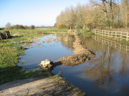
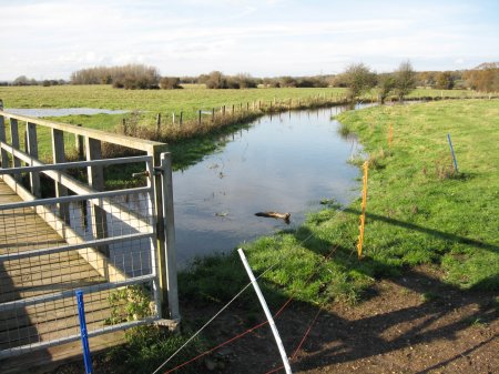
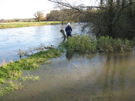
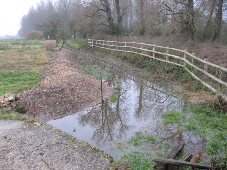
62L.
When river drops below 300, flow reverses, out of Mill Stream,
over hump at 300 and back into River. The Mill Stream 'reservoir'
begins to be emptied again.
|
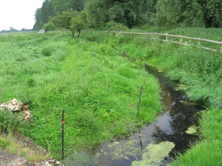
62r.
Taken 6 months after 62L, the new grass has altered the view.
|
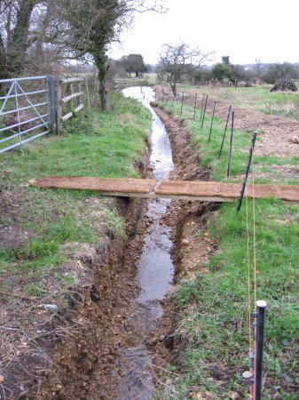
62p.
Taken 26 Nov 07, the Mill Stream with a bare spoil heap, a real eyesore.
|
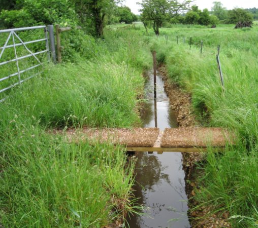
62q.
Taken 27 May 08, 6 months later,
showing the great healing power of Nature.
|
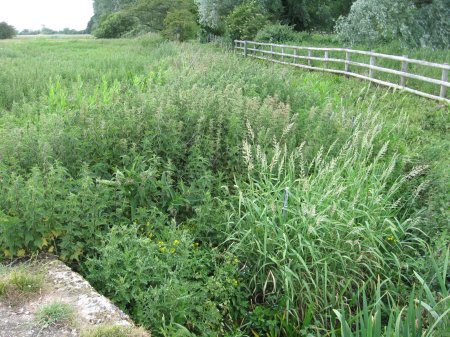
62s.
Taken 08 Jun 2011, 3½ years later, with dense vegetation.
|
Compiled, formatted, hyperlinked, encoded,
and copyright © 2007,
 All Rights Reserved.
|