From: "The Old Roads of Dorset" by Ronald Good, Page 42:
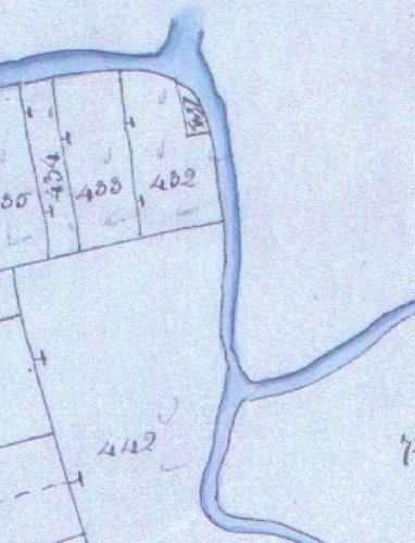
"....On the West side of Wimborne the story is interesting but complicated.
Historically it begins with the Roman Road from Badbury to Hamworthy which
ran South-East from near Cowgrove to a point a little West of Lake Farm,
where a minor loop of the river comes close to the present main road [A31].
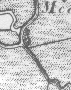
Next, Ogilby [1675], in his description of the road from Wimborne to Poole
(see p 56) mentions and depicts a road running Westward from near Canford to
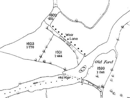
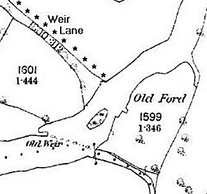
"Lakeford". Again, South of Cowgrove, and approached by Weir Lane, there is
an old ford just West of, that is to say, above, the spot at which the river
loop just referred to leaves the present main stream. Finally, South of
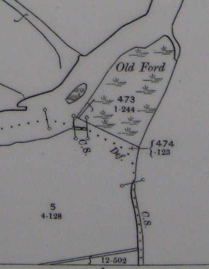
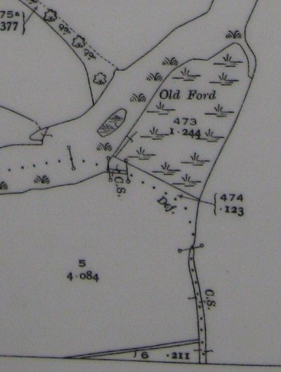
Pamphill there is a broad, hedged, approach to the river where a ford is
marked on 6" OS and where, until the Second World War there was a substantial
iron foot-bridge, Eye Bridge, though there does not seem to be any sign of a
road running to it from the South side. The clue to the explanation of all
this is that although Lake is now half a mile or so from the river both the
Roman road and Ogilby suggest strongly that there was a ford at Lake and if
so this can only have been on what is now the subsidiary loop of the river.
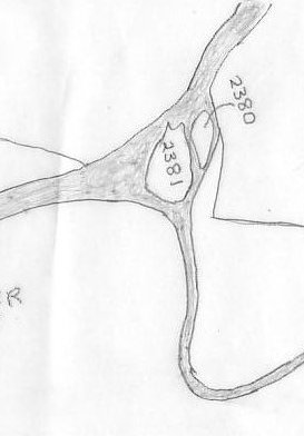
It therefore looks very much as if between the time of Ogilby, 1675, and
Taylor's map, 1765 (see p 53), which shows the river as it is now, the Stour
changed its course here, being either naturally or deliberately diverted
along its present more direct line from just East of Cowgrove ford to a
point South of Stone Park leaving the former, much longer, bed of the river
to become gradually reduced by silting and filling. If this is indeed so
then with the loss of Lake ford another crossing became necessary across
the new river south of Pamphill, and this is provided at Eye Bridge. Two
more points should be noticed. The Roman Road is shown on maps as changing
its course hereabouts, but this is not wholly convincing, and if the Southern
leg of the road is produced a little further north beyond its apparant
termination it comes very close to the presumed site of Lake ford. Second,
our idea that the river has changed is strongly supported, and some may
think even proved, by the fact that the old river loop was until 1933, and
is still partly, a local government and parish boundary like the main bed
West and East of it....."
|
 . All Rights Reserved.