Updated 9 Jan 2010
|
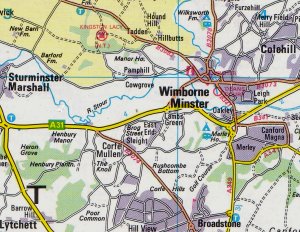
A 5-mile walk near Wimborne in Dorset
|
|
Robert Palmer
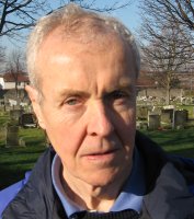 |
This 5 mile walk in Dorset was researched and written
by Robert Palmer of Hampshire, and encoded by his brother
John Palmer of Dorset. We hope you enjoy the lovely
countryside, at its best in Early summer. Comments and
suggestions to 
NOTE: 1-4 are in private land, contact
John Palmer for permission to walk. 5-19 are in National Trust and
public land.
ANSWERS to Questions
click here.
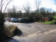
PARKING can be found at: 9/19, 13, 16 and 18.
Start at any of the carparks and do a circular walk.
|
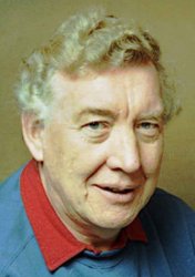
John Palmer
 |
Views along the Walk.
Numbers refer to hand-drawn map.
(© Robert Palmer 2008).
|
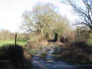
1. Bridleway to start.
 |
2. The coir bridge.
 |
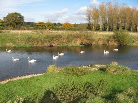
4. Swans on the Stour.
 |
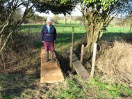
5. The cow squeeze.
 |
9. Eye bridge.
 |
13. Poplar Farm 
 |
15. Stile to bluebell wood.
 |
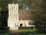
16. St Stephen's church.
 |
16. Cricket Ground
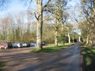 |
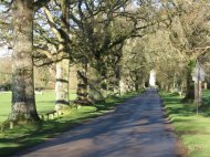
16. Avenue of oaks.
 |
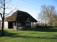
17. Cricket pavilion.
 |
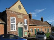
18. Pamphill school.
 |
|
18. Vine Inn and Palmer's beervan.
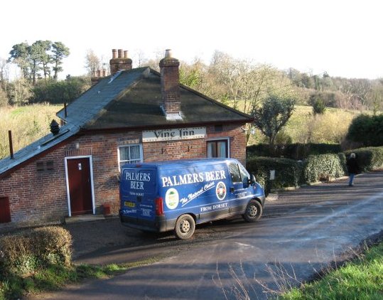 |
18. The Vine Inn
 |
19. Eye Bridge
 |
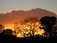
1. Sunset at Bear Mead.
 |
|
WHERE to START
- Get on the A31 heading West about 1.5 miles SW of Wimborne.
- To reach the start of the bridleway, continue West 400 meters
after the Esso petrol station and the bridleway
is on the right opposite the road to the left.
- Continue 400 meters along the bridleway and the gate to the start is
on the right.
- To arrange for the gate to be unlocked call 07889937799 (Robert Palmer)
and he will arrange for the gate to be unlocked by John Palmer.
Otherwise you can leave your car just beyond the gate. It will mean
possibly having to back up on your return.
- Then you can climb over the gate to your right or climb over the gate at
the end of the bridleway and back-track to the start.
|

|
At each number reset the distance to zero.
Start Map Reference ST 985 992
- Enter gate on right 100 metres from end of
bridleway. Directly ahead is the JCP Oak Plantation.
Turn left and walking due North parallel and
to the right of the bridleway hedge proceed 50
metres to a
coir matting bridge which you cross
and then a further 50 metres straight ahead across
the long thin field to a gap between two trees.
Q. Who does the plaque on the far side
of the left hand tree commemorate?
A.
- Entering the large field continue straight
ahead (North) for 140 metres to the bank of
the Stour.
Q. What is the River Level? A.
- Turn right and proceed East along the South
bank of the Stour for 275 metres.
Q. What is the OS Reference? A.
Q. What type of birds nest is it? A.
Q. What trees are being grown? A.
- Continue east along the river bank for 325
metres to the cow squeeze.
Q. What is the mobile phone number of the owner? A.
Q. What is a cow squeeze? A.
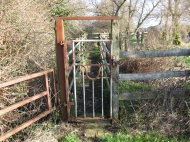
- Enter the cow squeeze
immediately after
crossing the matted bridge over the newly
constituted millstream which was excavated by JCP
to reinstate the millstream after in excess of
100 years. After passing through the cow squeeze
you are in National Trust Land. Continue East
along the river bank for 140 metres when you
cross two gates at the let down.
Q. What is a let down? A.
- Continue straight ahead East along the river
bank. After 330 metres the path veers to the
right away from the river. Continue along the
path with the fence on your left towards Eye
Bridge in the distance for 325 metres.
Q. What do you find at this point on your
left and how did it get here?
A.
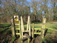
- Continue ahead for 150 metres and then
cross the stile to your left.
Q. What is the bird on the stile? A.
- Walk up to and across the
Eye Bridge
and turn left at the far (North) side of
the bridge. Read the National Trust sign.
Q. Which eight fish do you find in the Stour? A.
Q. Which 9 'feathered friends' do you find? A.
- Pass through the Green gate and continue
West along the North bank of the Stour on
the path. After 315 metres you come to two
seats.
Q. What organization is mentioned on these seats? A.
Q. What were Land girls? A.
|
- Continue ahead. After 60 metres you
come to an animal on the left.
Q. What is the animal? A.
- Continue ahead and after 700 metres you
come to a stile which you cross.
Q. What is the make of padlock at the stile? A.
- After passing over the stile, turn right away
from the river,
walk ahead with the fence to your right, turning right after
150 metres, left after 200 metres, across a plank
bridge at 300 metres, joining a sunken track
at 400 metres, crossing a small bridge at
830 metres, another 890 metres, and at
1,000 metres coming out at the metalled road
at Cowgrove.
Q. What is the name of the cottage to
your right? A.
- Cross the road and turn left by the
telephone box and Poplar Farm.
Continue ahead
on the track with the road to your left,
past the thatched cottage to your right at
200 metres, passing through the gate by the red
brick house at 575 metres to the signpost at
600 metres.
Q. What makes you think of April 1st? A.
- Turn right along the answer to your last
question, proceed through 2 gates at 50 metres, go
under the power lines at 150 metres. At 900
metres in the Spring you can make the detour on
the left into the best bluebell wood in Dorset
and return the way you came. At 1140 metres you
come to the metalled road.
Q. What is the number at 1140 metres, on your left? A.
- Turn right onto the road. After 225
metres there is a church (St Stephens) to your left.
Q. What is the name of the "jewel in the
crown" National Trust Estate to which the church belongs? A.
Q. And how did it come to pass to the National Trust? A.
- Turn right (South) on to the path just
to the right of the metalled road going off
to the right at the road junction. After 60
metres you pass a signpost on your right. You
enter a parking lot at 80 metres and at
140 metres after leaving the parking lot you
turn half right along an indistinct path
between the waste paper bin on your left and
the gravel private driveway immediately on your right. You
walk anticlockwise around the boundary of the cricket
pitch and at 500 metres you come to the thatched
cricket pavillion.
Q. What is the date on the Pavillion? A.
Q. What was the main event that year?
- Continue ahead and at 120 metres turn
right on to the metalled road. At 190 metres
there is an old sign on the school in stone.
Q. Who was the founder of the school? A.
Q. What date was it founded? A.
- Continue ahead along the metalled road
to "The Vine" Inn at 350 metres.
Q. What 4 traditional country ales does it serve? A.
Cross the bridge and retrace your
steps to the starting point.
Distance 9 km (5½ miles).
|
STOP PRESS!!
Robert Palmer predicts
McCain
as next US President.
Timeline: 5 Feb 2008
|
|
Compiled, formatted, hyperlinked, encoded,
and copyright © 2008, John Palmer,
All Rights Reserved.
|