Updated 22 Mar 2011
|
Dorset Stour - Statistics
|
|
Dorset Stour - Statistics.
|
This page shows
FREQUENCY of
river HEIGHT and
watertable LEVEL over
a 6 year period 2003-2009 at Bear Mead.
Location of Bear Mead:
2,100 metres upstream of Julians Bridge, Wimborne Minster, Dorset, UK.
and 1,090 metres upstream of Eyebridge.
Also dates of FLOODS
and HIGH WATERS.
|
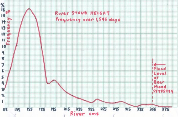
Percentage of DAYS at stated River HEIGHT.
Sample=1,545 days between Aug 2003 and Jun 2009.
Data Source: daily readings taken by author, see
Numbers and
Graphs.
Datum: Centimetres referred to scale in river Stour at SY985994
 |
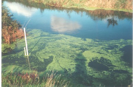
River Stour with measuring scale in Eye Mead.
Used as reference datum for river HEIGHT.
 |
|
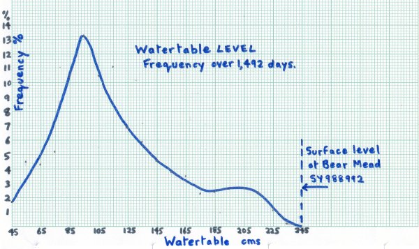
Percentage of DAYS at stated Watertable LEVEL.
Sample=1,492 days between Aug 2003 and Jun 2009.
Data Source: daily readings taken by author,
see Numbers and
Graphs.
Datum: Centimetres referred to scale in well at SY988992
Note: Watertable datum + 60 = River datum
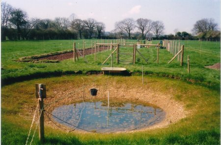
Well with measuring scale in floodplain about 230 metres
South of River Stour. Used as reference for Watertable LEVEL.
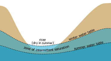
Seasonal movement of Watertable.
| DATA used.
Frequency measured in days
for each 10 cm range.
15 Jul 2003-19 Jun 2009
(days) Water (days)
River Freq. Table Freq.
38x 1
37x 1
36x 2
35x 8
34x 6
33x 5
32x 2
31x 8
30x 13 24x 1
29x 12 23x 3
28x 10 22x 17
27x 13 21x 36
26x 20 20x 40
25x 11 19x 40
24x 17 18x 36
23x 23 17x 34
22x 30 16x 52
21x 35 15x 57
20x 53 14x 69
19x 68 13x 89
18x 59 12x 103
17x 152 11x 167
16x 224 10x 157
15x 249 9x 199
14x 225 8x 155
13x 154 7x 78
12x 97 6x 64
11x 47 5x 67
4x 26
|
|
Compiled, formatted, hyperlinked, encoded,
and copyright © 2009, John Palmer,
 All Rights Reserved. All Rights Reserved.
|