Updated 04 Jun 2012
|
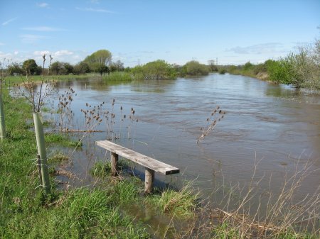
Flooding at Bear Mead 01 May 2012
|
|
Flooding at Bear Mead 01 May 2012.
|
A description of the high flood on 01 May 2012 at Bear Mead.
|
After no rain for 30 days, and 2 dry winters with no flood since
November 2009, the weather suddenly changed in mid-April to produce
the "wettest April on record". There were 3 floods close together,
on 27 Apr, 01 May and 02 May. The Mayday Flood was the highest,
at R=376 at 1400 hrs. The Author managed to get down to the River
Stour in waders, and collected these photos.
filename(timeBST) Taken by 
|
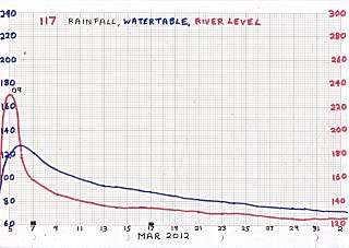
05 Mar 2012 - 02 Apr 2012
 |
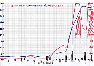
03 Apr 2012 - 1 May 2012
123456789012345678901234567890123
FLOOD-12 -13
 |
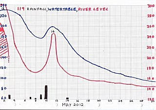
02 May 2012 - 30 May 2012
-14
 |
|
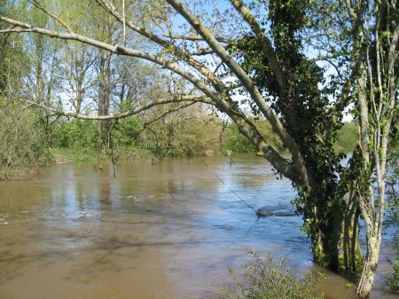
3135(1309). The Stour burst its banks....
 |
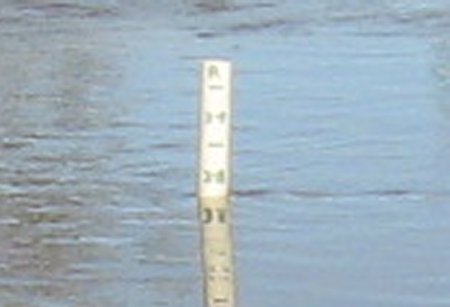
3133s(1306). ...The depth was 376
(taken 1 hour before peak).
 |
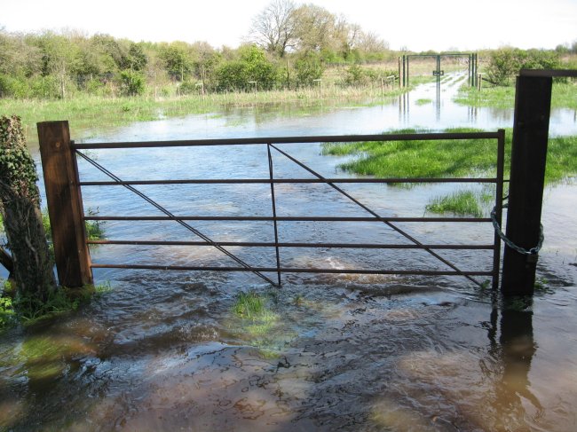
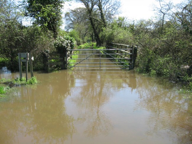
3128(1245). The water reached 700 yards to the A31 gate...
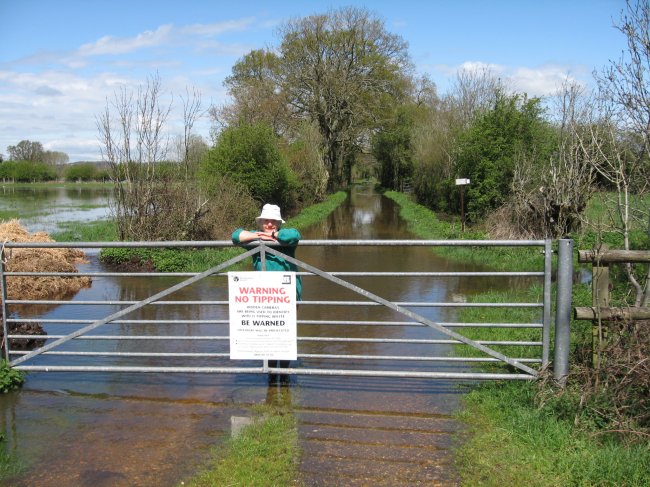 |
3116. ...and covered surrounding fields.
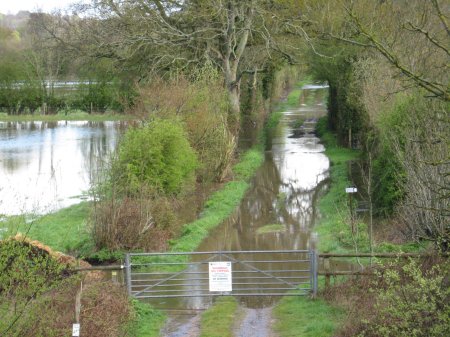 |
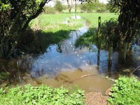
3129(1255). The bridleway looked like a canal...
 |
3130(1258). ...and water flowed into the Plantation.
 |
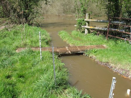
3131(1259). The Plank bridge over the ditch vanished...
 |
3136(1317). ...and the seat in the hedge vanished too.
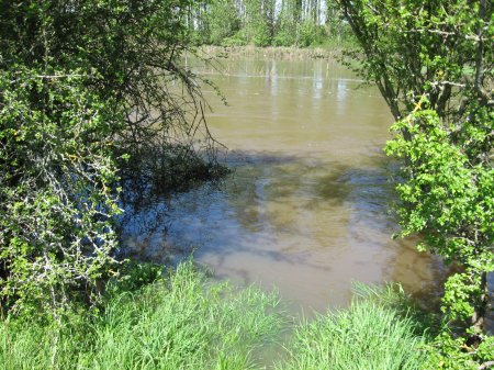 |
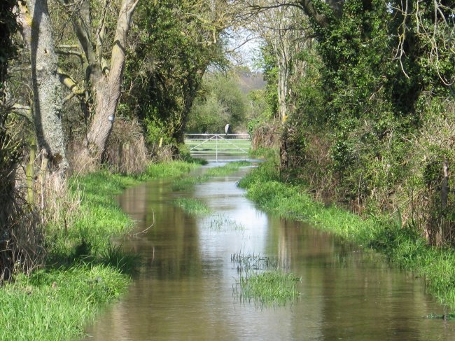
3137(1321). The Mill Stream was full...
 |
3141(1409). ...and the end of the bridleway was full.
 |
3138(1323). The Pendulum was at 45°...
 |
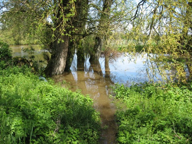
3139(1327). ...and the Willow Wood became an island again.
 |
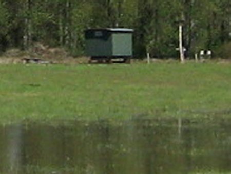
3132(1303).
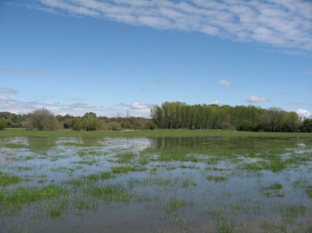
Field #1 was flooded except for the NE corner...
 |
3132v(1303).
...but the hut was still high and dry.
 |
Compiled, formatted, hyperlinked, encoded,
and copyright © 2012, John Palmer,
 All Rights Reserved. All Rights Reserved.
|