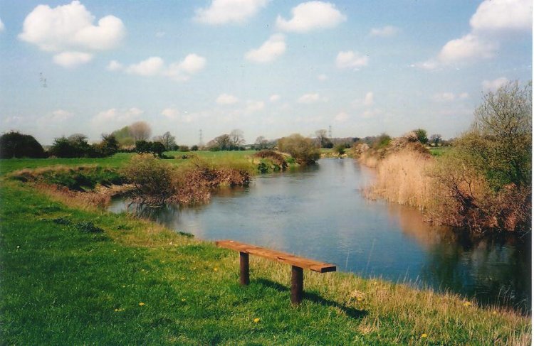
Looking upstream, 40 miles to the source in Wiltshire.
|
Looking downstream, 20 miles to the sea at Christchurch.
|
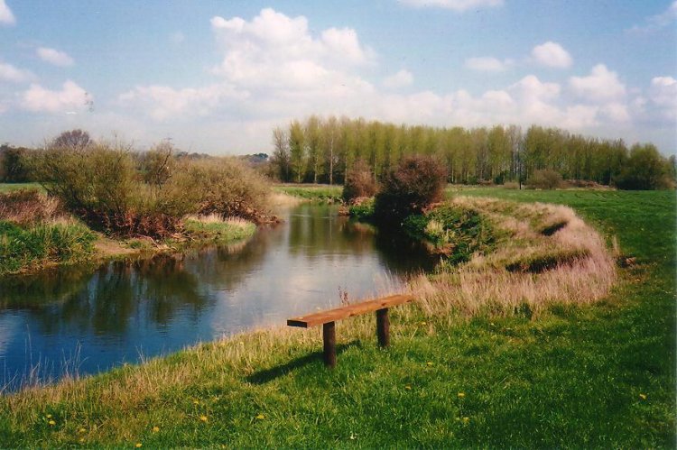
Bear Mead on the South bank of the Dorset Stour is
a beautiful place,
25 acres of meadow and pasture, old hawthorn hedgerows dotted with
big ash trees, and the river gliding by. Wimborne Minster and
Charborough Park tower can be seen in the distance, the bells
heard on Sundays, and there are often spectacular sunsets across
the flat floodplain. Deer, swans, herons,
moorhens and coots are seen every
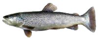
day. There is private fishing (a 7 pound chub was caught recently)
and no right of way crosses Bear Mead. The occasional canoeist paddles
upstream from Eye Mead bridge towards White Mill bridge. The nearest road or
house is 700 yards away.
|
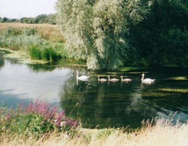
Swans on the Stour at Bear Mead
|
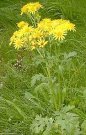
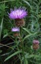
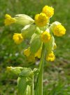
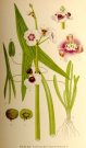
Some flowers on Bear Mead riverside and meadow.
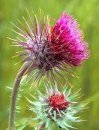
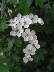


(see lots more...)


|
Because much of the river's course is across clay soil the
water level varies greatly. In summer low water level makes the river
a diverse and important habitat, supporting many rare plants. In winter
the river sometimes floods, and is therefore bordered by wide flood plains.
To preserve the rich riverbank flora, cattle and sheep are not allowed
and the lush pasture grass is cut by machine in June. Part of Bear Mead
is devoted to a plantation of oak saplings from Sherwood Forest.
The history of Bear Mead is intruiging.
In 1813 the area was affected by the Inclosures Act, owners had to
erect heavy wire and post fences before ownership was awarded. Today's
mature hedges were probably planted then. Use was all pasture or meadow.
Nearby is the site of a now-vanished and little-known
watermill called Lake Mill. Fishing Rights are let to
Salisbury & District Angling Club (who call the beat
"Bear Mead Fishery").
Contact the warden and webmaster on 
|
1. Five fields called "Bear Mead" on the Stour about 1 mile west of Wimborne
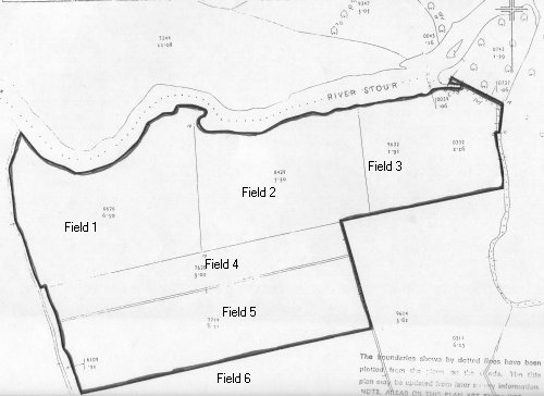
Points of interest: The Southern bank in Field 1 has been protected
with stone blocks and angular flints, to prevent erosion. About 1965
River Authorities scoured the river and placed the blocks for protection.
|
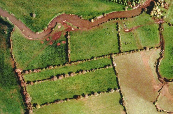
2. A modern arial photo of the same area.
|
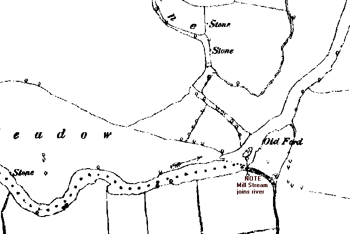
3. The "panhandle" on the Eastern border of Bear Mead,
including the remnants of a mill stream
|
In medieval times, water was taken from the Stour to feed Lake Mill Stream,
which wound its way across Eye Meadows before returning to the Stour
just below the present Weir. The Old Mill (now disappeared) lay where the
A31 Lake Gates roundabout now is, on OS reference 9955-9912. The stream has
now silted up (or been filled) where it takes from the Stour. The curious
"panhandle" shape of the legal boundary remembers the day when the Mill
Stream was important enough to be used as the Parish boundary. The two
islands shown on the 1847 Tithe Map have now united
and joined the South Bank, but are covered with large trees that may date
back 200 years. The "zag" in the boundary where it crosses the Mill Stream
may reflect the existence of field 431 in 1840.
|
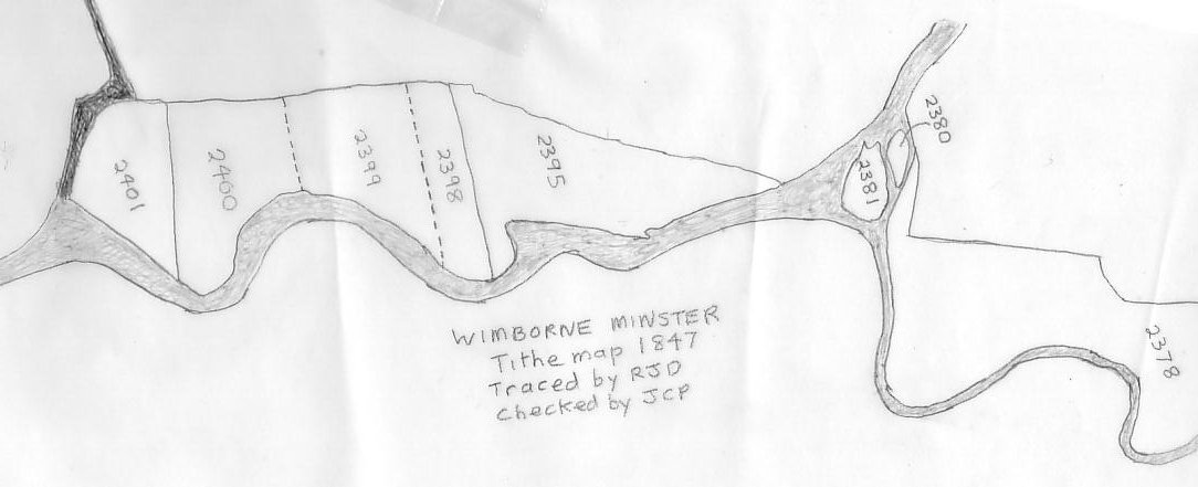
4. North of the Stour in Wimborne Minster parish,
traced from an 1847 Tithe map at Dorset Record Office.
|
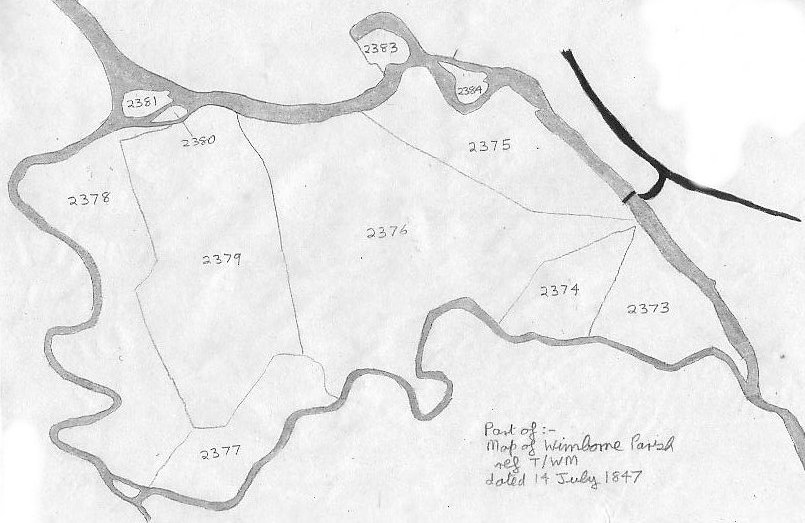
5. Eye Mead in Wimborne Minster parish,
traced from an 1847 Tithe map at Dorset Record Office.
Points of interest are: The islands, which have today welded themselves to
the South bank,
and the curious "Lake Mill Stream" which meanders across
the fields only to rejoin the Stour again.
The major and minor loops of the Stour surround an Island Meadow giving
rise to its old name "Eye Mead".
Latest thoughts
The area covered by fields 2373-2379 is called "Eye Mead"
meaning Island Meadow.
The island effect was created by the minor loop of the Stour,
which has today almost silted up. The peninsula on field 2373 where the two
Stours re-met, and the oxbow, show the water in the minor loop once had a
sturdy flow. Today the minor Stour short-cuts the peninsula, which has
welded to the South shore . Lake Mill was located near the little
island and field 2377, at OS reference 9955-9912 where there is a low
earth platform. The section bordering 2378 was important enough to form
the Corfe Mullen Parish boundary. Rodney Legg says "Traditional
agriculture used to encourage the flooding [of these meadows] in winter
as this prevented the ground freezing and brought on an early crop of
grass." The first 40 yards of the loop (2381-2378) appears to have been
filled in, not silted up, could this be to block the loop entirely
and prevent flooding of the A31?
|
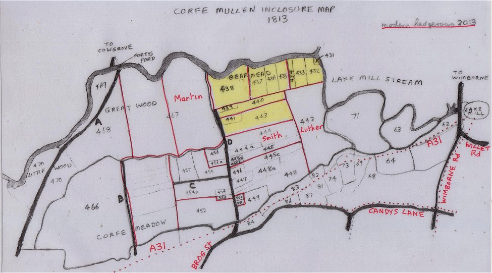
6. South of the Stour in Corfe Mullen parish,
traced from an 1813 Inclosure map at Dorset Record Office.
Interesting points are: location of Lake Mill, Fortis Ford and
trackways A,B and C, all now disappeared.
The A31 trunk road had not then been thought of, and the now disused
S & D Railway had not been built.
"Little Wood" and "Great Wood" are intriguing names in a now treeless area,
Bear Mead is a name now disappeared, and "Lake Mill Stream" is now
stagnant because of infilling at the upper Stour end.
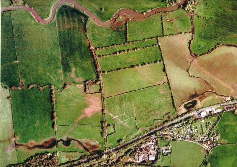
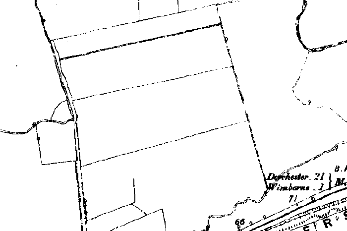
7. an aerial photo of the same area
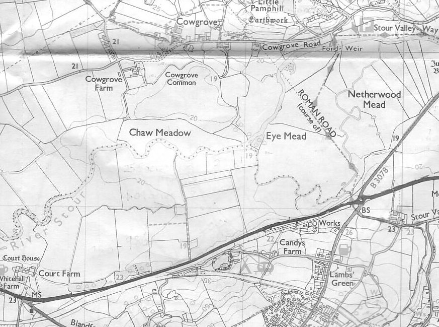
 8. The same area on a modern map
9. Fishing around Wimborne
(Fishing Rights are let to
Salisbury & District Angling Club)
|
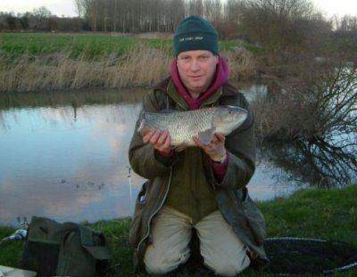
5lb 2oz chub caught by Simon Cooper from Devon 27 Feb 05
|
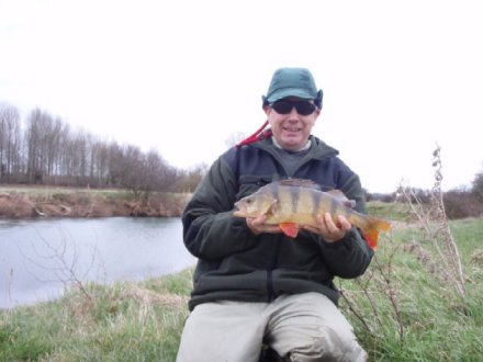
Chub caught by Paul Forshaw from Devon
|
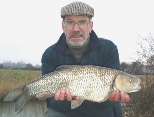
"Following our river side chat on Saturday I enclose a picture of
my
personal best perch at 3lb 6oz caught at Bear Mead on 23.2.08."
Ralph Pond
|
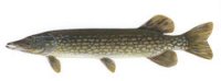
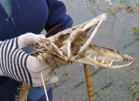
Remains of a pike left by the river bank about 8 Feb 2009. It survived
the flood on
the 10th, and was quickly stripped to the bone. The author has preserved
the skull.
|
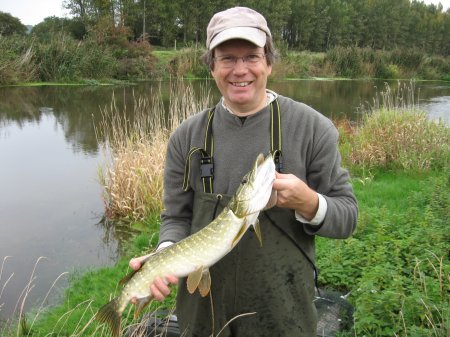
Ralph Pond from SADAC caught a pike at Bear Mead on 5 Oct 2010
|
Info collected from Dorset Records Office 27 Nov 02
     about Bear Mead and Corfe Mead land
North of the River Stour, Tithe Map 1847

No    Landowner              Occupier            Name             Cultvtn  A--R--P
2378  George BANKES          Charles John LOUCH  High Meadow      Pasture  18-2-37
2380  George BANKES          William JACKSON     Island           Pasture  00-1-00
2381  George BANKES          William JACKSON     Island           Pasture  00-3-06
2395  John RAINDLE           Himself             Chard Mead       Pasture  07-3-36
2398  William MACKRELL       James TOREY         Mitchell Meadow  Pasture  02-2-35
2399  Henry HILL             John RAINDLE        Mitchell Meadows Pasture  05-0-17
2400  Matthew RAINDLE        Himself             Mitchell Meadows Pasture  05-2-32
2401  George CLAPCOTT        John FRAMPTON       Mitchell Meadows Pasture  03-1-26

South of the River Stour, Tithe Map 1840

No    Landowner              Occupier            Name             Cultvtn  A--R--P
431   George HATCHARD        Himself             Bear Mead        Meadow   00-0-24
432   Matthew RANDALL        Himself             Barn Mead        Meadow   01-2-04
433   John RANDALL           Himself             Bear Mead        Meadow   01-2-04
434   William BOUND          Himself             Corfe Mead       Meadow   00-2-13
435   William CASTLEMAN      Thomas MARTIN       Bear Mead        Meadow   01-2-00
436   William CASTLEMAN      Thomas MARTIN       Bear Mead        Meadow   01-2-11
437   John CARLTON           Himself             Bear Mead        Meadow   02-1-23
438   Wm Jn BANKES esq       Wm HART Geo TOPP    Bear Mead        Meadow   06-1-18
439   Charles BANTING        Samuel EATON        Corfe Mead       Meadow   00-2-13
440   Augustus KEMP esq      Thomas MARTIN       Corfe Mead       Meadow   02-2-08
441   Wm BEAMINSTER          Henry JENKINS       Corfe Mead       Meadow   00-3-33 "part of Field 5"
442   Jn Willett WILLETT esq William BOUND       Corfe Mead       Meadow   12-2-11
443   George WESTON          Ann WAREHAM         Corfe Mead       Meadow   05-2-01 "part of Field 5"
444   Fred COVENTRY esq      George SHINER       Corfe Mead       Meadow   02-0-00
444a  Fred COVENTRY esq      William BOUND       Corfe Mead       Meadow   01-0-32
444b  Fred COVENTRY esq      William BOUND       Corfe Mead       Meadow   01-1-10
444c  Fred COVENTRY esq      William HARRIS      Corfe Mead       Meadow   02-1-02
445   Fred COVENTRY esq      William HOLLOWAY    Corfe Mead       Meadow   02-2-13
445a  Eleanor BARFOOT        Herself             Corfe Mead       Meadow   00-1-00
445b  Jn Willett WILLETT esq Eleanor BARFOOT     Corfe Mead       Meadow   00-1-09
445c  Jn Willett WILLETT esq Eleanor BARFOOT     Corfe Mead       Meadow   01-3-28
446   George HATCHARD        Robert SHOREY       Corfe Mead       Meadow   00-2-39
447   Rev Edward BRETT       Robert SHOREY       Corfe Mead       Meadow   01-0-11
448   Chris WARLANDS         George BROWN        Corfe Mead       Meadow   05-2-36
448a  Jn Willett WILLETT esq George BROWN        Corfe Mead       Meadow   02-1-06
449   Ed,Hy+Chas CASTLEMAN   Henry JENKINS       Corfe Mead       Meadow   02-3-30
450   Augustus KEMP          Himself             Corfe Mead       Meadow   00-0-39
451   Fred COVENTRY esq      George SHINER       Corfe Mead       Meadow   00-0-33
452   Henry BARTLETT         Samuel EATON        Corfe Mead       Meadow   07-2-22
453   Jn Willett WILLETT esq Joseph KNIGHT       Corfe Mead       Meadow   00-0-37
454   Hubert ROBBINS         Joseph KNIGHT       Corfe Mead       Meadow   00-1-21
454a  Rev Edward BRETT       Joseph KNIGHT       Corfe Mead       Meadow   03-3-27
455   Rev James MAYO         Matthew JENKINS     Corfe Mead       Meadow   02-1-31
456   Fred COVENTRY esq      Isaac LAWS          Corfe Mead       Meadow   01-0-22
456a  Jn Willett WILLETT esq Isaac LAWS          Corfe Mead       Meadow   00-1-14
457   Rev James MAYO         Matthew JENKINS     Corfe Mead       Meadow   02-0-07
458   William HARRIS         Matthew JENKINS     Corfe Mead       Meadow   00-2-33
458a  Fred COVENTRY esq      James LITTLE        Corfe Mead       Meadow   00-1-26
467   Fred COVENTRY esq      William BOUND       Great Wood East  Meadow   34-0-37

Tithe Awards 1813
     Unto and for the said John Willett WILLETT as Lord of the Manor of
Corfe Moleyn Saint Nicholas and George WESTON his Lessee All that parcel
of Land No 443 containing five acres two roods and one perch bounded on
the East by the Allotment No 442 South East by the Allotment No 444
South West and part of the North West by the said Road marked D and the
Allotment No 441 and remaining part of the North West by the Allotment
No 440 The Fences for enclosing the said Allotment No 443 on the South East
and West sides I award and declare shall be made and for ever hereafter
kept in repair by and at the expence of the said George WESTON and the
future owners of the said Allotment for the time being.
|
Surveyed Water Levels
|
Readings taken with laser surveyor on 7 Dec 2003 at 1345 hours
OS spot height at SY 990-994 ("Marker 19") is 19 meters above mean sea level.
So the height of the Mill Stream is 129 cms on the unofficial scale.


Unofficial Scale   Feature         Surveyed height difference
(344 cms)--------- Marker 19--------------
                                   difference 190 cms
(154 cms) -------- River Stour------------
                                   difference 25 cms
(129 cms) -------- Mill Stream------------
|
Wildlife seen at Bear Mead and Eye Mead
|
BIRDS
Buzzards
Sparrowhawk
Kestral - adult male + others
Grey herons
Little Egrets
Kingfisher
(fisherman at Eye Bridge has had
2 kingfishers sitting on his rod!)
Cormorant
Mute swans - pairs and immatures - 30 seen together in Field 1
Odd couple - swan with damaged wing + unknown species of goose
Red-crested Pochard ducks
Mallard ducks
Coot
Moorhen
Redshank
Chinese goose, domestic species)
Pheasants
Lapwings
Green woodpeckers
Long tailed tits in a flock
Swifts
Magpie
Male Smew
Snipe
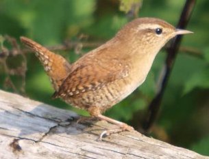
Wren
Chiff Chaff
Song thrush
Chaffinch
INSECTS
Hoverflies
Dragonflies (Red)
Damselflies (Blue)
Water boatman
Whirligig beetles
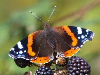
Tortoise shell butterfly
Peacock butterfly
Bumble bees
ANIMALS
Water vole
Field vole
Field mouse
Wood mouse
Deer - roe and sika
Moles (in molehills)
Otter
Stoat or weasel seen at a distance
Grey squirrels
Fox trotting across the field
Horse leech (found while ditch digging - ugh!)
Pippistrelle bat
Frogspawn
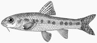
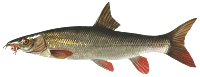
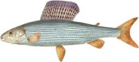
FISH
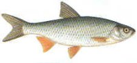
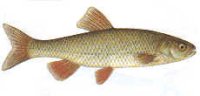
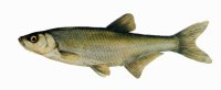
Chub (7 lbs +) caught by fisherman
TREES & PLANTS
Big trees are mostly ash in hedges
oaks in hedges (only 3)
Dog rose in hedges
Hawthorn
Brambles
Blackthorn
Ivy
White willow
Grey Poplar plantation
Holly (small)
Honeysuckle
Yew tree (one, very small)
|
REF. 1
|
From: "Place-names of Dorset" by A D Mills,
Part 2, page 19, Parish of Corfe Mullen.
Bear Mead (v. bearu "wood" or baer "woodland pasture")
Source 1839 TA71 (Tithe Awards, in PRO and in DRO)
Also "Great Wood" 1742, "Little Wood" 1742, "Corff Mead" 1657.
|
REF. 2
|
From: "Place-names of Dorset" by A D Mills,
Part 2, page 166, Parish of Pamphill
(before 1894 was in parish of Wimborne Minster).
Eye Bridge and Mead. SY995995.
"Eye" is first mentioned in 1253 ref Col C D Drew.
Eye Mead is encircled by the River Stour and its tributeries.
"I(e)g" (West Saxon) meaning "an island"
|
REF. 3
|
From: "The Old Roads of Dorset" by Ronald Good, Page 42:
"....On the West side of Wimborne the story is interesting but complicated.
Historically it begins with the Roman Road from Badbury to Hamworthy which
ran South-East from near Cowgrove to a point a little West of Lake Farm,
where a minor loop of the river comes close to the present main road [A31].
Next, Ogilby [1675], in his description of the road from Wimborne to Poole
(see p 56) mentions and depicts a road running Westward from near Canford to
"Lakeford". Again, South of Cowgrove, and approached by Weir Lane, there is
an old ford just West of, that is to say, above, the spot at which the river
loop just referred to leaves the present main stream. Finally, South of
Pamphill there is a broad, hedged, approach to the river where a ford is
marked on 6" OS and where, until the Second World War there was a substantial
iron foot-bridge, Eye Bridge, though there does not seem to be any sign of a
road running to it from the South side. The clue to the explanation of all
this is that although Lake is now half a mile or so from the river both the
Roman road and Ogilby suggest strongly that there was a ford at Lake and if
so this can only have been on what is now the subsidiary loop of the river.
It therefore looks very much as if between the time of Ogilby, 1675, and
Taylor's map, 1765 (see p 53), which shows the river as it is now, the Stour
changed its course here, being either naturally or deliberately diverted
along its present more direct line from just East of Cowgrove ford to a
point South of Stone Park leaving the former, much longer, bed of the river
to become gradually reduced by silting and filling. If this is indeed so
then with the loss of Lake ford another crossing became necessary across
the new river south of Pamphill, and this is provided at Eye Bridge. Two
more points should be noticed. The Roman Road is shown on maps as changing
its course hereabouts, but this is not wholly convincing, and if the Southern
leg of the road is produced a little further north beyond its apparant
termination it comes very close to the presumed site of Lake ford. Second,
our idea that the river has changed is strongly supported, and some may
think even proved, by the fact that the old river loop was until 1933, and
is still partly, a local government and parish boundary like the main bed
West and East of it....."
|
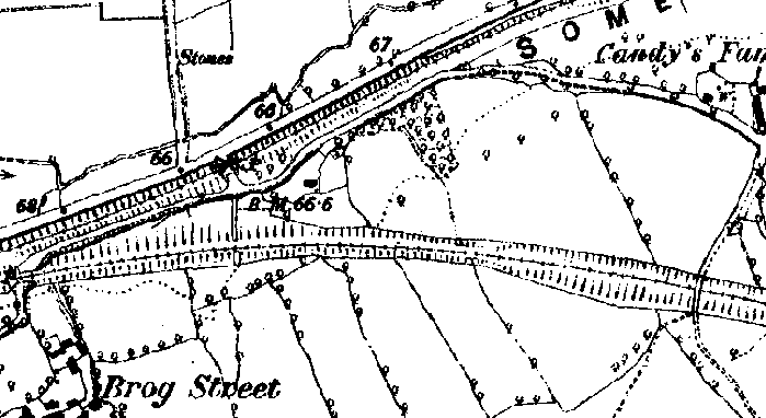
Publication date: 1890 |
Citation:'England - Dorset: 034/NE', Ordnance Survey 1:10,560 - Epoch 1 (1890). |
www.british-history.ac.uk |
Date accessed: 02 March 2012. |
Supporting documents: Historical Legend - Scale 1:10560 County Series
|
********

**
**
|
Seven keys for Bearmead have been copied and given
to the co-wardens Alan and Susan Jones
for their use.
| |
Compiled, formatted, hyperlinked, encoded,
and copyright © 2004, John Palmer, All Rights Reserved.
|